
The main developments which gave shape and chronology to the emergence of the North Esplanade in its present form were: the Royal Clarence Hotel; the Spa development and the Round Tower lighthouse; the churchyard walkway which later became Marine Cove Gardens; the Customs House and Steam Packet Inn, and finally the Reed Arms and the residential terraces such as Kinver, Catherine and Julia, which linked and bracketed the older sites. Additionally there were the phases of development of the sea defences: the pre 1912 wall and embankment; the post 1912 sea wall and esplanade extension and the new sea defences of the mid 1980s following the 1981 flood.
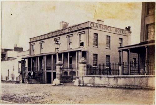
The earliest known deeds of the Royal Clarence Hotel date from 1792. This was the period when the future King William IV was still the popular Duke of Clarence. The Hotel was originally built at the head of a causeway which extended from the sands to the brink of the river. It was more than once swept away by floods during its construction.
When Steart House was built as part of the Spa project from 1822 there were no doors constructed at the seaward side of the building. At the time of its construction only sand dunes existed here with the sand frequently blown onto this area.
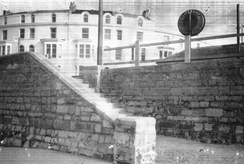
As part of his Spa development The Rev Davies is said to have buttressed the dunes west and northward of the church yard with an inclined stone wall along the top of which was placed iron railings. However the records of Samuel Nash tell us that a 14 ft high sea wall had been constructed here earlier, in 1813, by the Commissioners of Sewers. In any case the dunes had been levelled and grassed to provide an elevated walk. Davies allowed the public to promenade here and this continued until 1846 when it was closed possibly due to some abuse. Numerous indignant letters were written by people assuming it was public land. Part was later built on (Vicarage Terrace) the rest eventually became Marine Cove.
Bath Chronicle May 1834:

The Customs House on the Esplanade (currently a Fish and chips Bar) was erected in 1846 according to J Salisbury’s 1859 ‘Handbook of Burnham’. This guide tells us that “Here all vessels entering the port of Bridgwater are examined by Her Majesty’s Customs, and the dues assessed. At present all vessels approaching the coast to discharge a cargo at any point between Bridgwater and Berrow pay dues to the former corporation.”
The ‘Steam Packet’ Inn (now York House) was standing by the time of the Peachey Williams survey of 1838 but it is likely it was a private residence of some importance at that time, as it is one of only two listed as ‘House and lawn’ rather than ‘House and garden’ suggesting the owners were of the leisured class. The first reference to it as an Inn’ is in 1861. Throughout the 1860’s it provided commercial accommodation and some stabling facilities. Next door to the Customs House, it was a popular rendezvous for the seafaring community.
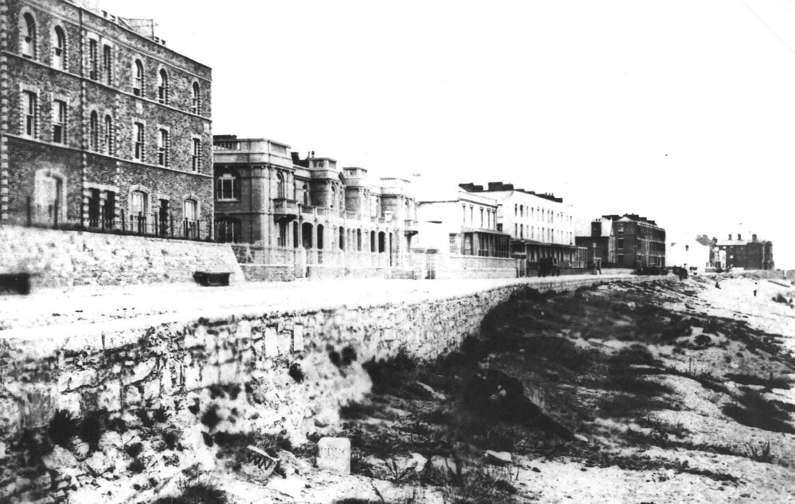
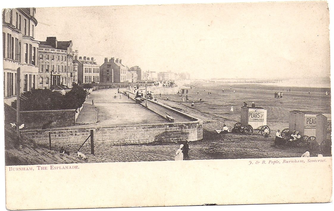
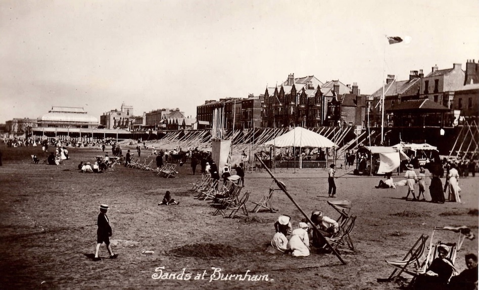
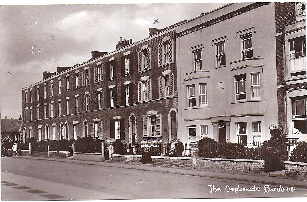
Kinver Terrace was built around 1843 for seaside holiday makers and known then as Prew’s Terrace. It was the first of the sea front terraces to be built as Burnham expanded in the late 19th century. There was still at that time no Esplanade in the sense that we know it today, just the sand dunes; and it is said that when Prew’s Terrace was first built its drains went through the sea wall and straight on to the beach. The picture below shows Prew’s Terrace at centre with the building which housed the Atlantic Cafe on the left. The sea wall and promenade is as yet almost totally undeveloped.
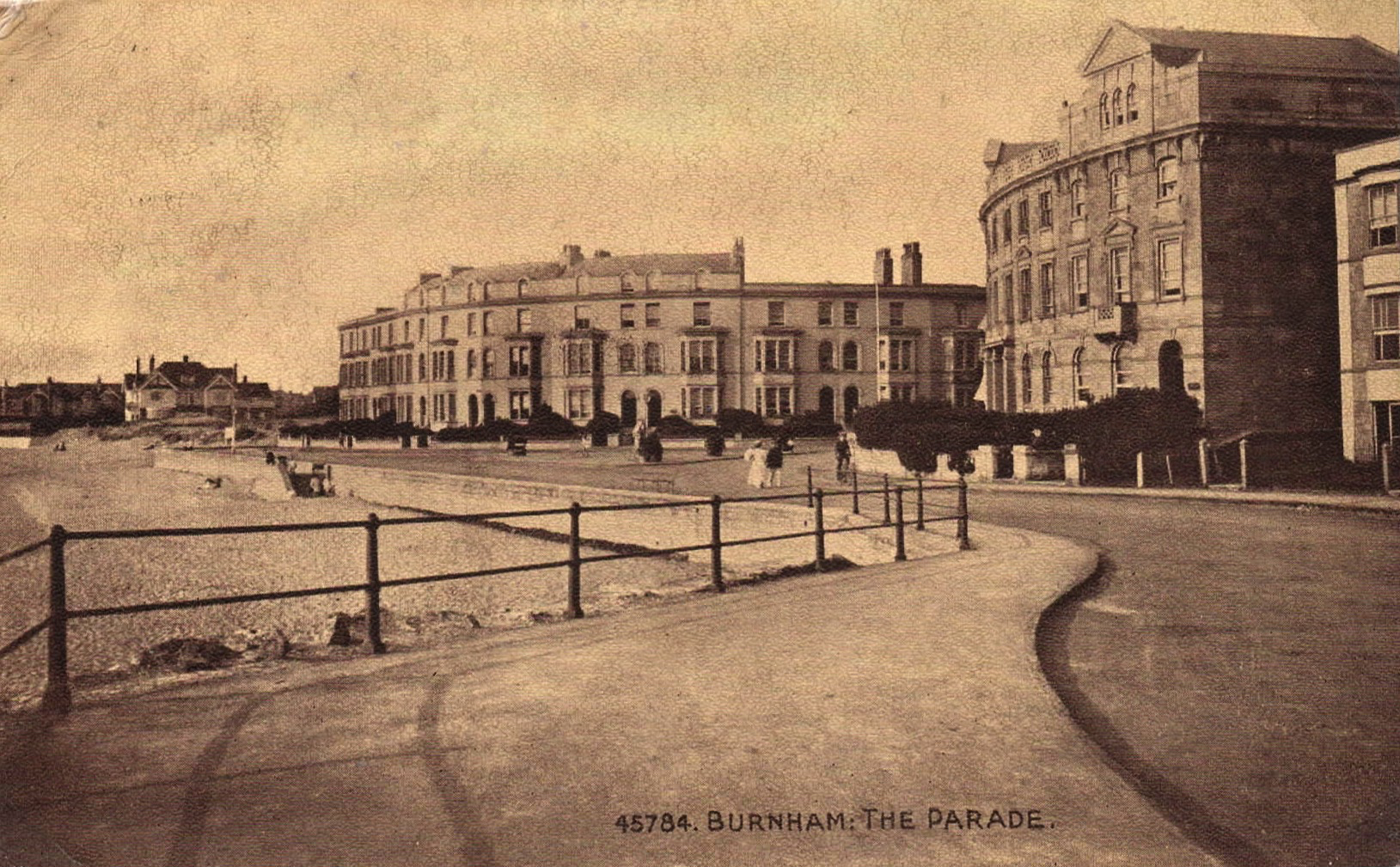
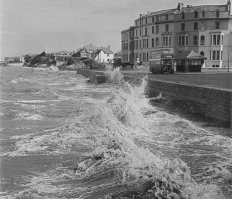
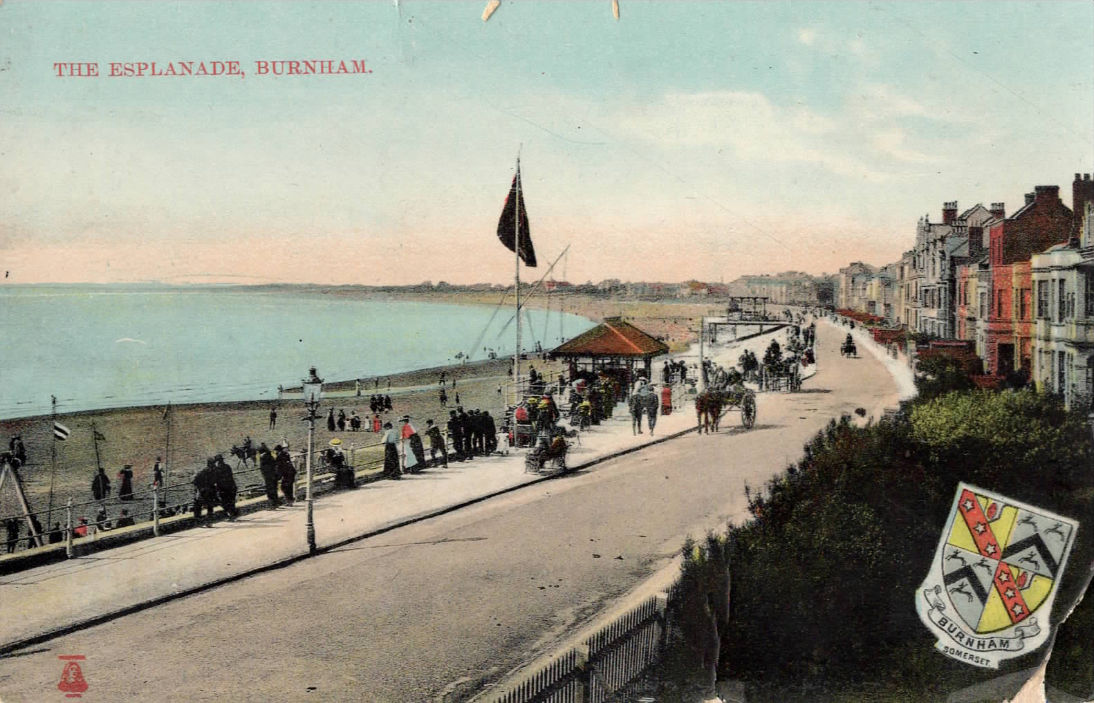
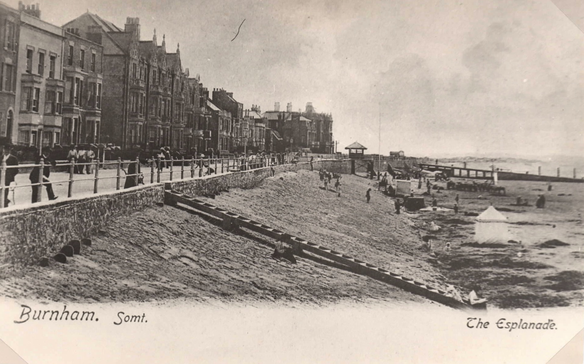
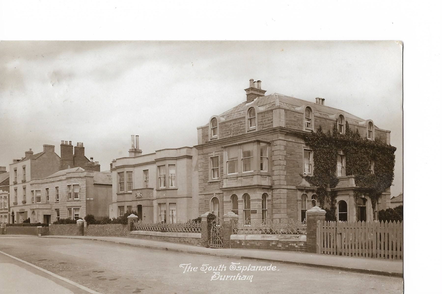
The Esplanade as we see it today really started to take shape during the 1840’s & 1850’s, but it extended only the width of the road in front of the new terraces, and was buttressed by a stone slope. The beach lay immediately beyond, resulting in the properties being lashed by water at stormy high tides. In parts, such as the northern ‘parade’ in front of Catherine & Julia Terraces, there were originally not even any rails, merely a low wall and a double flight of steps leading down to the sand. Photos show that railings were eventually installed along most of the length.
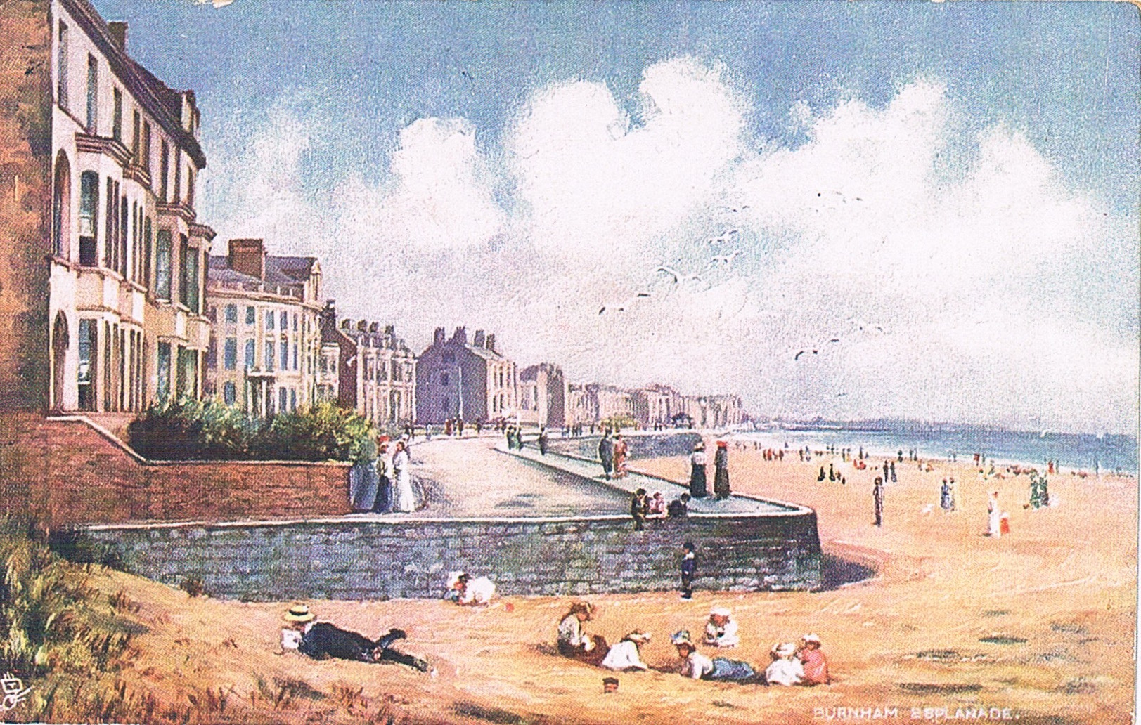
Picture above is an early coloured view from the north at Maddock’s Slade which was where the esplanade began. Below is same place on a photo postcard showing bathing machines with pears advertising.
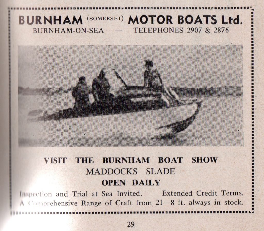
There was a boat yard in this area which continued in existence until the building of flats on the site in the late 20th century. Latterly this was the home of the Burnham Motor Boat Company (Advert below from Burnham Guide of 1959)
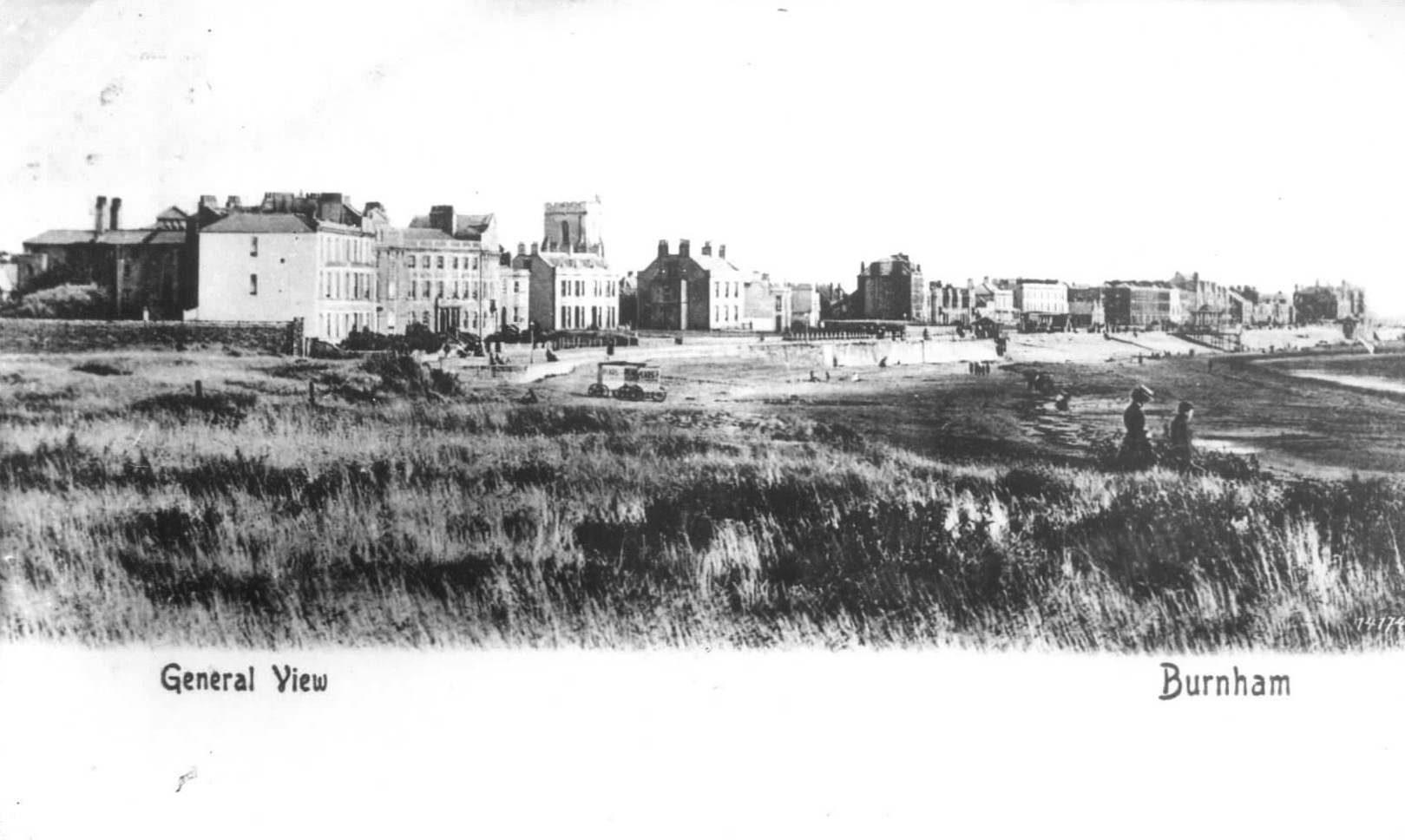 Above is a view from the dunes to the north of this area.
In 1855 the ‘National School’ establishment, later to become St Andrew’s school, was erected on the Esplanade at the expense of leading Burnham developer George Reed who gave a site described as a sand warren, on the sea front at the top of what is now College Street, for education of children “of labouring, manufacturing and other poorer classes”. The school was opened in 1857. Due to its exposed position the school incurred gale damage and initially the only heating was from coal fire which smoked badly in a west wind.
Built at the south end of North Esplanade by Reed in the late 1850‘s the Reed’s Arms hotel opened its doors in April 1860 to a new era of tourism in Burnham
George Reed was also responsible for the erection of the two fine terraces at the north end of the North Esplanade which are named after his daughter Catherine and Granddaughter Juliana (Julia). Prior to this time there was only a large area of sand dunes and warren extending southward from the Poplar road area to the church.
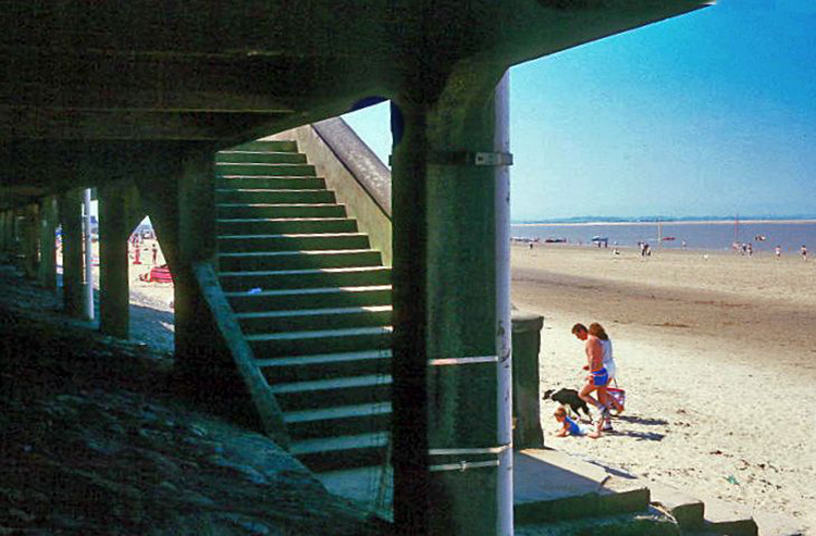
Details of the building of these terraces are not clear. Some sources indicate that they were in planning from the 1850’s and construction may have begin before the end of that decade. Another source tells us that Catherine Terrace (the south crescent in Sea View Road) was built in 1861. The north crescent, Julia Terrace, was described by Revd. Dupuis as still a carcass in 1867. The interior was not finished until several years after the building. The plaza area which now exists between the properties and the sea was built as part of the new sea defences after the floods of December 1981.
The picture above was taken in the 1960’s
The original steps (below) became known to generations of children as the ‘sliding steps’ due to their smooth balustrade.
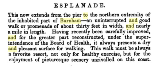
The J. Salisbury ‘Handbook of Burnham’, 1859, describes the Esplanade thus:
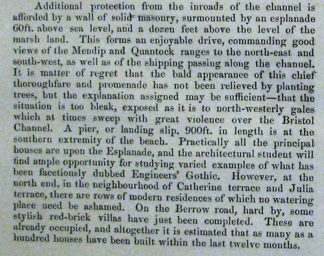
In 1884 the Bristol Mercury Guide to Burnham says:
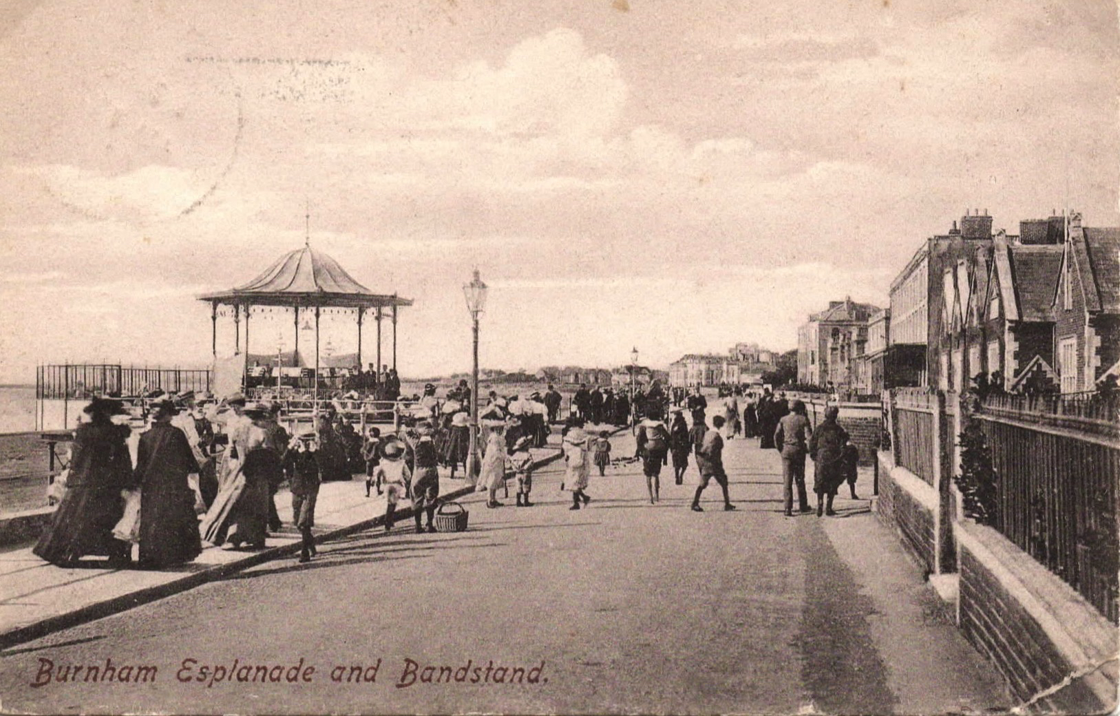
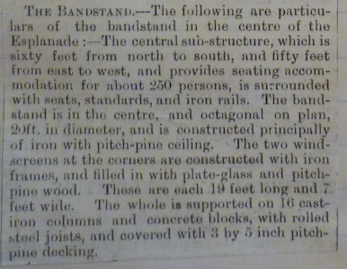
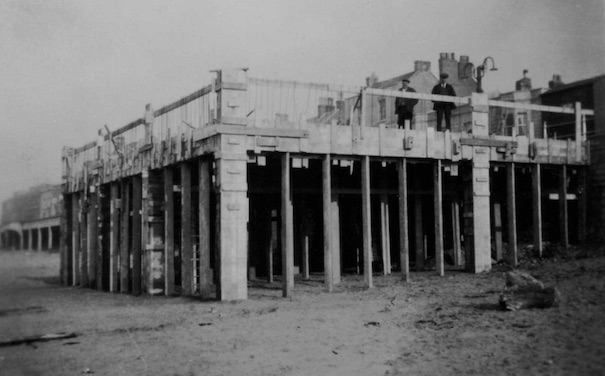
In 1901-2 it was decided to commemorate the coronation of Edward VII by construction of a bandstand & 2 public shelters, one at the north end opposite the churchyard entrance and one at the south end opposite the Customs House, each being supported on columns outside the line of the Esplanade.
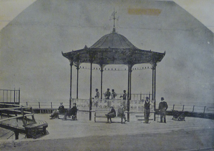
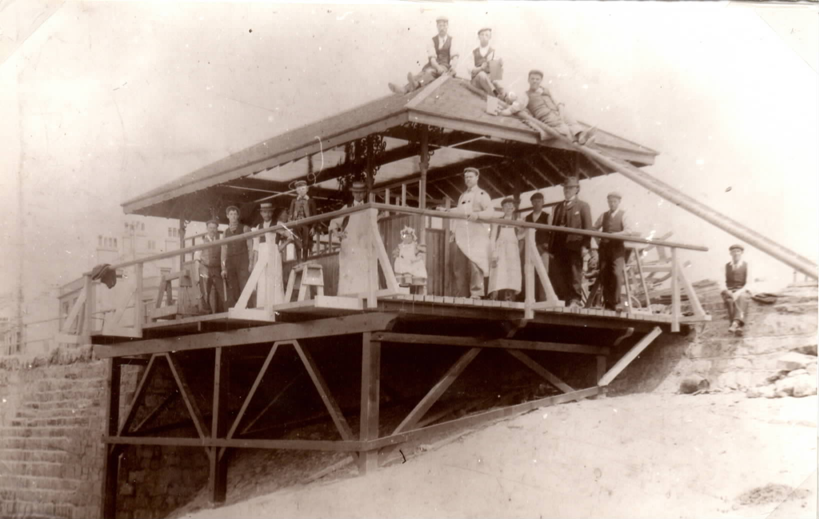 The picture above shows the building of the North Shelter in 1901, opposite the entrance to the Churchyard. On the roof are Fred Farthing (left) and Arthur Dyer (right).
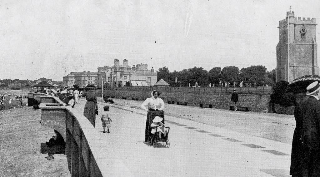
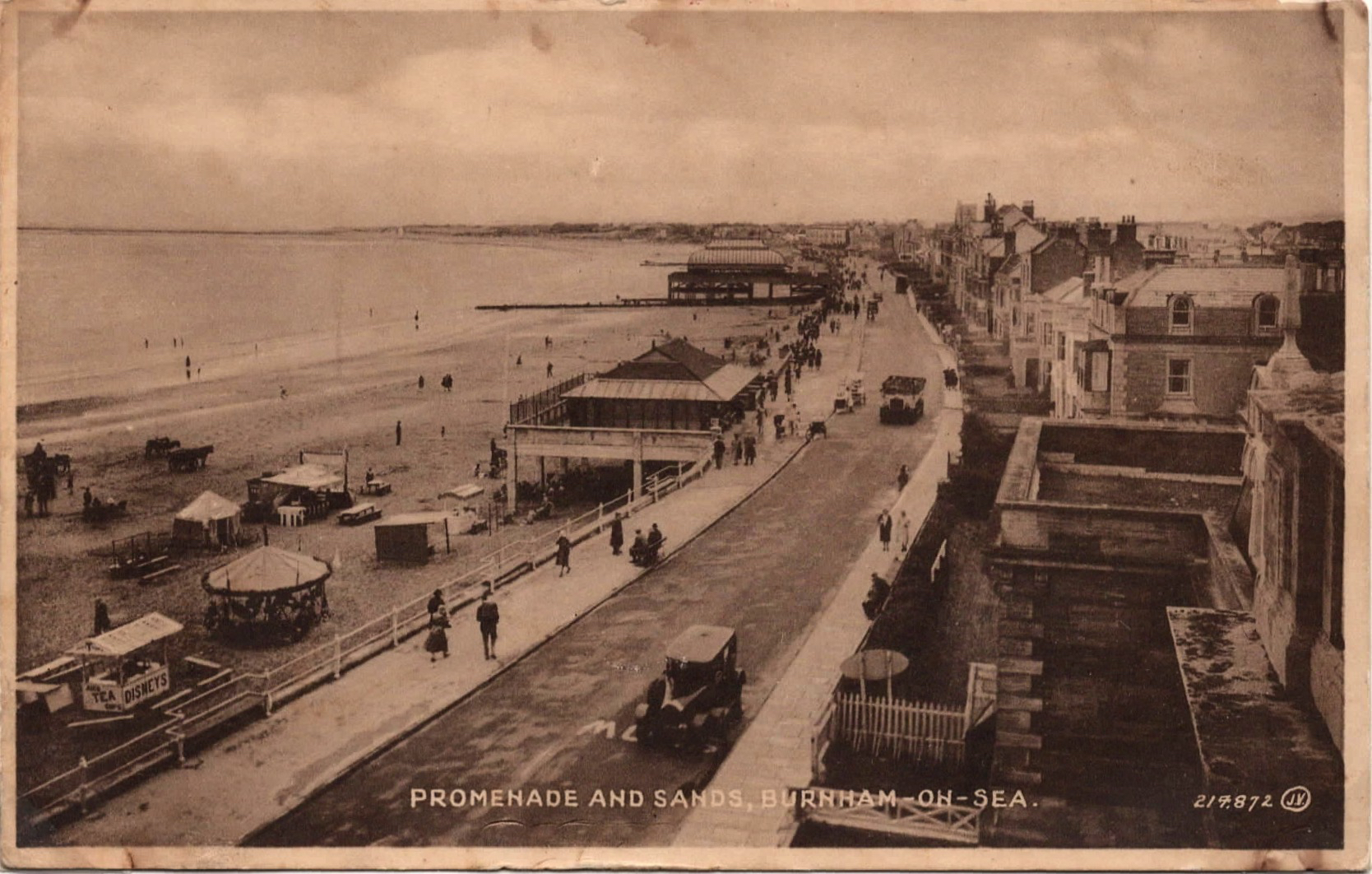
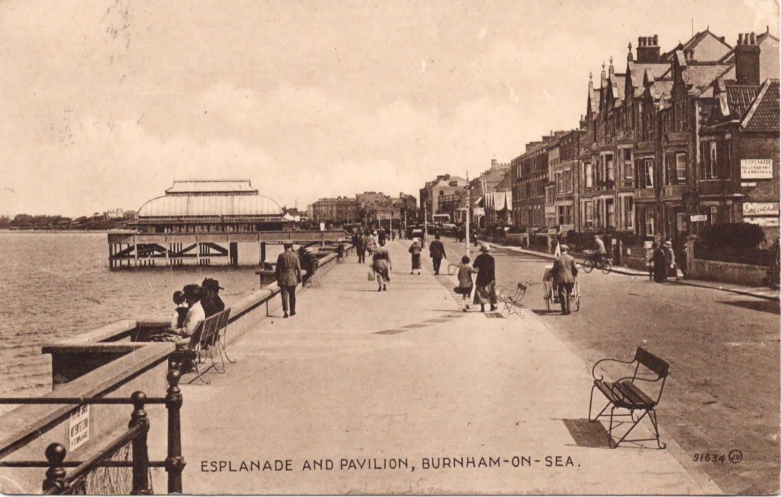
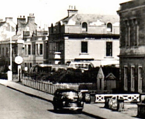
The Esplanade was widened between 1911 and 1914. Plans were drawn up in 1910 and approved by the Government Inspector despite mixed views in the town (some concern about the likely rates increase). A new promenade supported on concrete pillars was built out over the old stone slope for most of its length. This used the then new material ferro-concrete. Two new shelters replaced the old ones and a short pier was incorporated into the design to support the Pavilion. The designer of the Esplanade & Pavilion works was local surveyor William Chowens. It is believed that the old south shelter was reconstructed as the bus shelter in the triangle at the top of Sea View Rd (see photo from 1960’s above).
On the postcard below the construction can be seen still underway at the south end.
In the next picture the new esplanade extension can be clearly seen, including the metal grids on the landward side to allow venting of water upwards in rough conditions. Many people will remember these metal covers being thrown out of their holes by the water pressure. The wall at right in front of the Churchyard indicates that this picture was taken before the development of Marine Cove
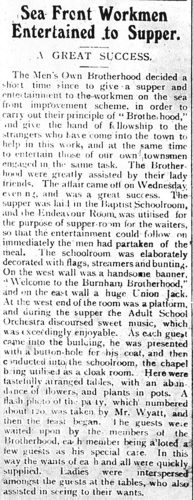
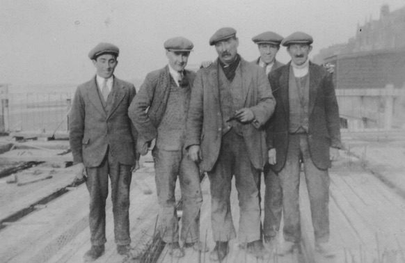
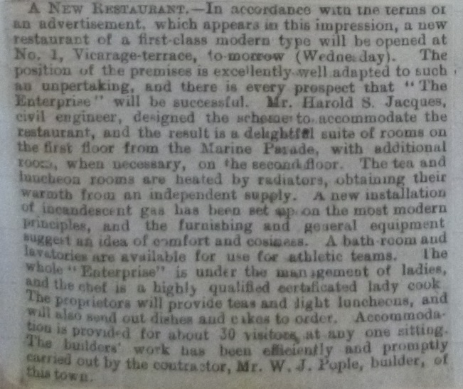
Below is a report from the Burnham Gazette of 3rd March 1912 about a reception for the workmen from a South Wales Contracter, who undertook the new works.
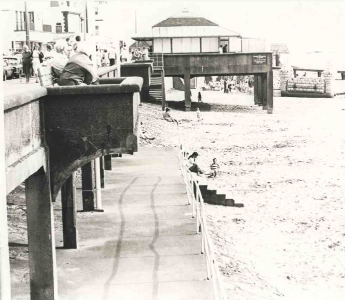
The picture below shows the extended esplanade and the South Shelter in more recent times, not long before its demolition for the building of the new sea defences.
The next three pictures show the 1902 and 1912 shelters respectively, before and after the new esplanade extension. The Custom House flag pole can be seen in the first two pictures. The second picture gives a good view of the pre 1912 sea wall and also Farthings carriages on the beach.

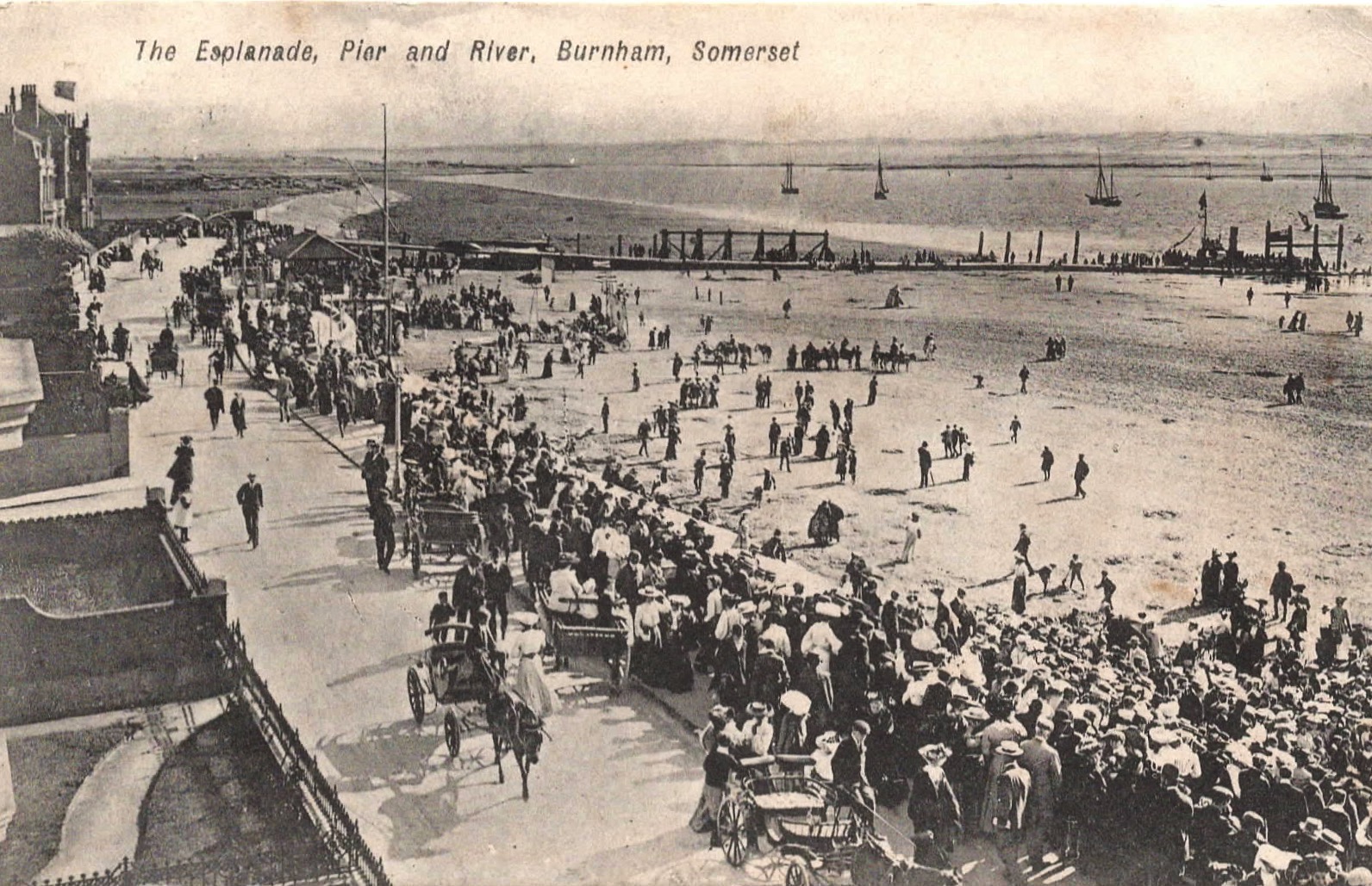
Above is an interesting picture showing the 1902 shelter & the jetty with wooden piles. A busy scene with horse carriages and crowds on the Esplanade – is this a special event, or just normal summer crowds?
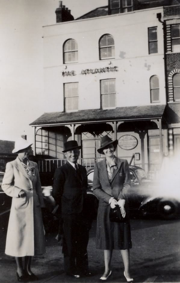
We believe the local press report below (from 1909) refers to the terrace of buildings between Marine Cove and Vicarage St, the northernmost of which (presumably No 1) became the Atlantic Hotel and later the Atlantic Cafe. It was demolished in the late 20th century to make way for flats (Vicarage Court).
Below, the terrace between College St and Cross St during the early 20th century, the pavement grids indicate this is after the Esplanade extension.
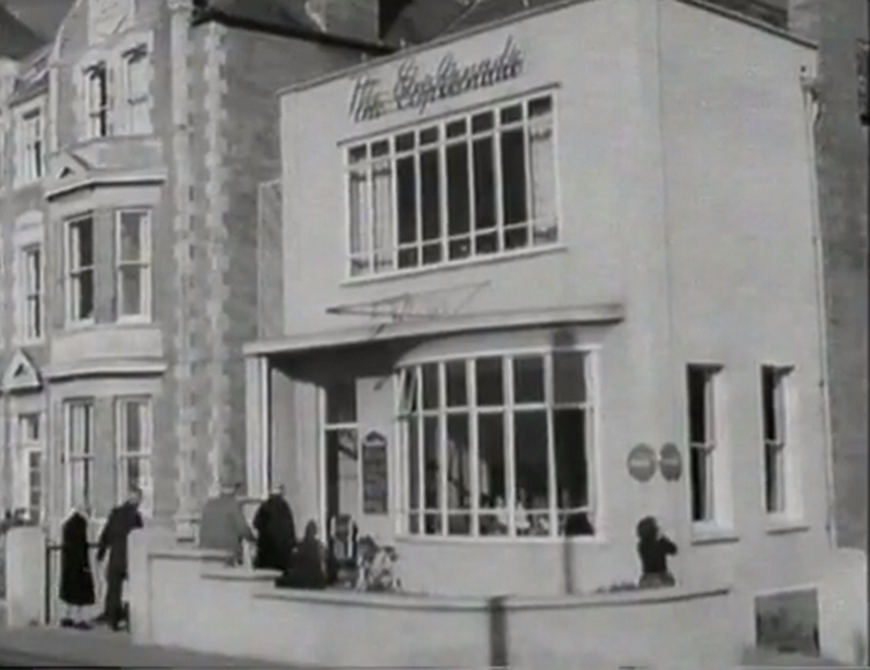
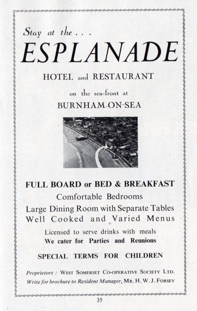
Above is a view of the terraces of buildings between Cross St and Adam St before the 1912 works. Note the old wooden steps which were later linked to the extended Esplanade by stone stairs. In the centre of the picture is the building which became Russell’s Esplanade Restaurant (at right in first picture below) and later The Esplanade Hotel & Restaurant.
Advert below from Burnham on Sea Guide 1950
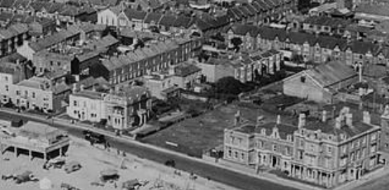
In the picture above we can see the Esplanade from South St to Pier St taken some time after 1912 but before the development of Wem’s Coach Depot on the open land north of the Reed’s Arms which was laid out as a putting green. Note the Electric Theatre already in place at the back of this plot opposite the houses of ‘Sunny Lawns’.
Below is a postcard showing York House (left), the Customs House (centre) and Sunset House, later WEMS Coaches (right), the front fencing of the putting green can be seen at far right. Note that this postcard is labelled as ‘South Esplanade’ as it shows the south end of the Esplanade before what became South Esplanade was developed in the 1930’s
In the picture below the front of the putting green and its kiosk can also be see, with a WEMS coach and petrol pump in the background.
————————————————————————————-
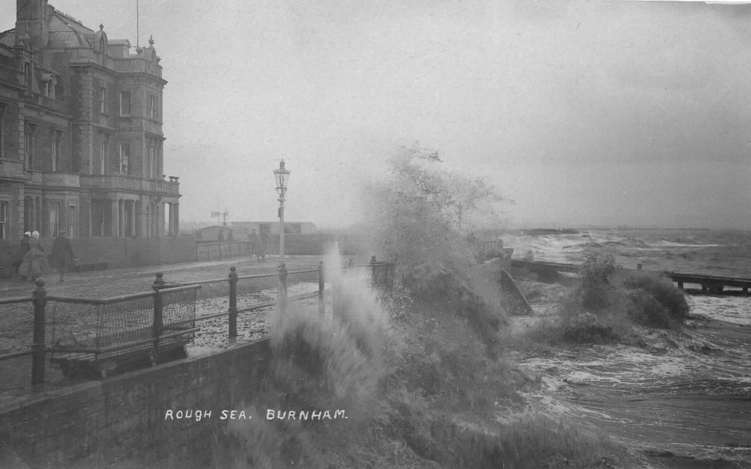
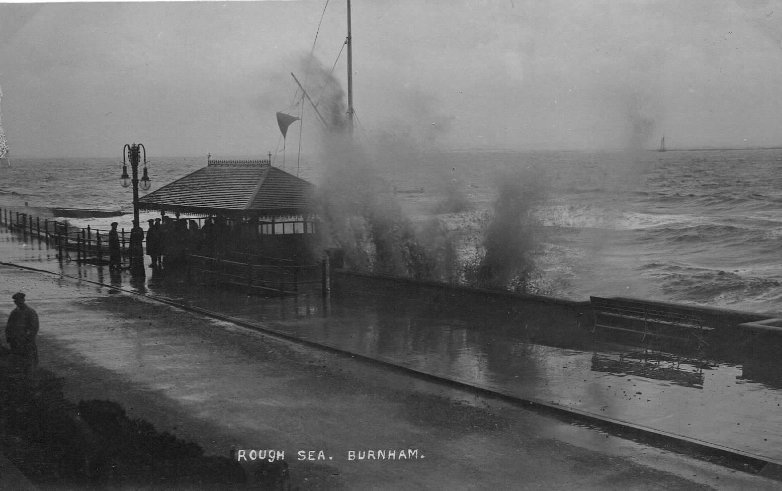
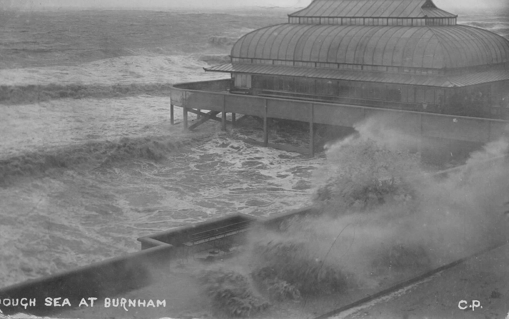
ROUGH SEAS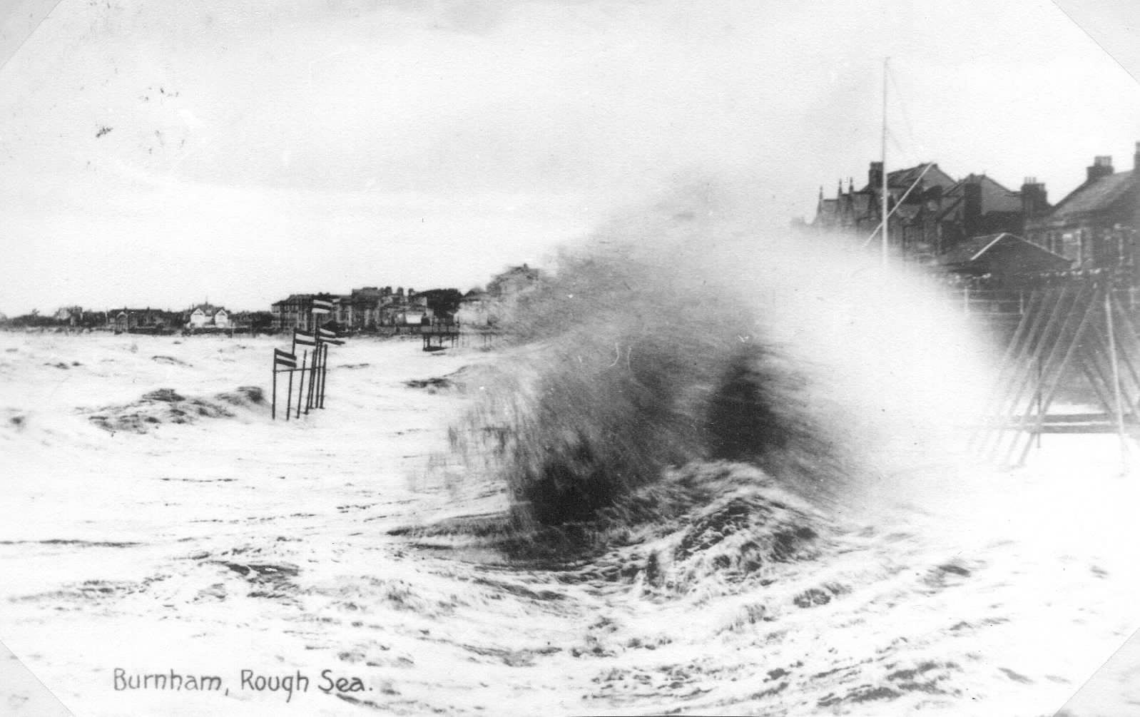 1902-11
 1912
1912
 1914
1914
————————————————————————————-
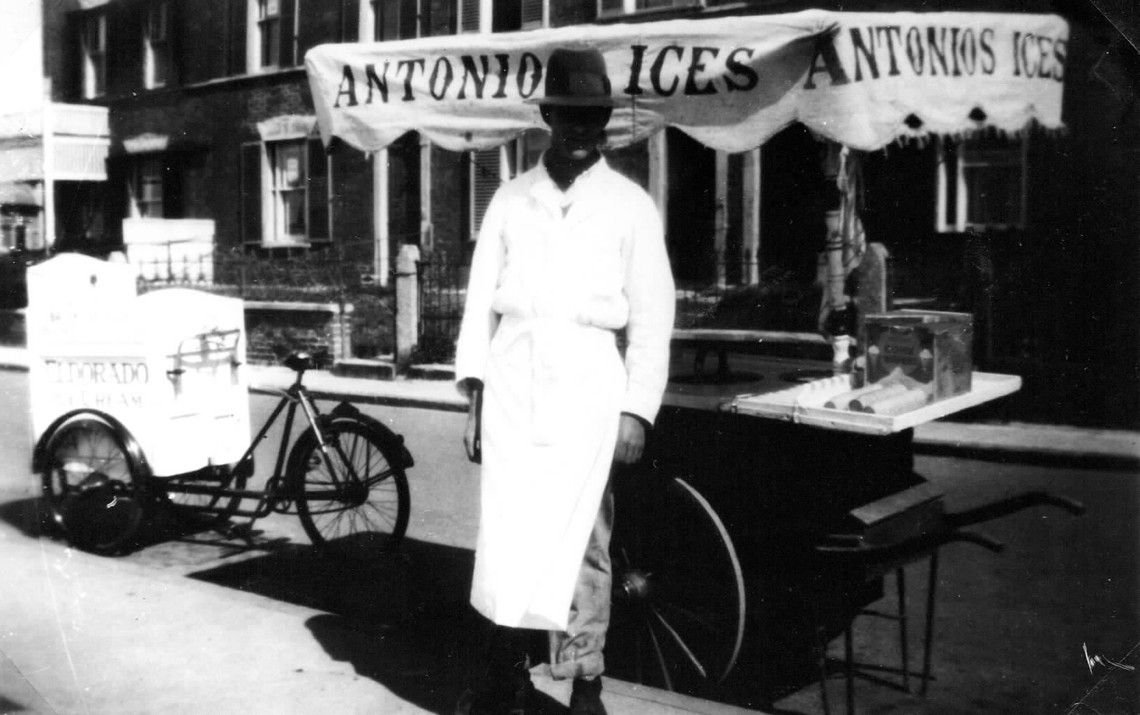
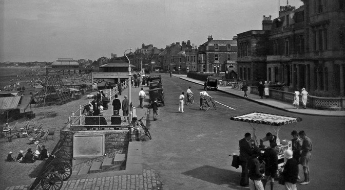
In better weather Antonio’s Ice Cream cart was a common sight on the Esplanade (see also picture at top of page), here seen with a tricycle, possibly bringing additional supplies?
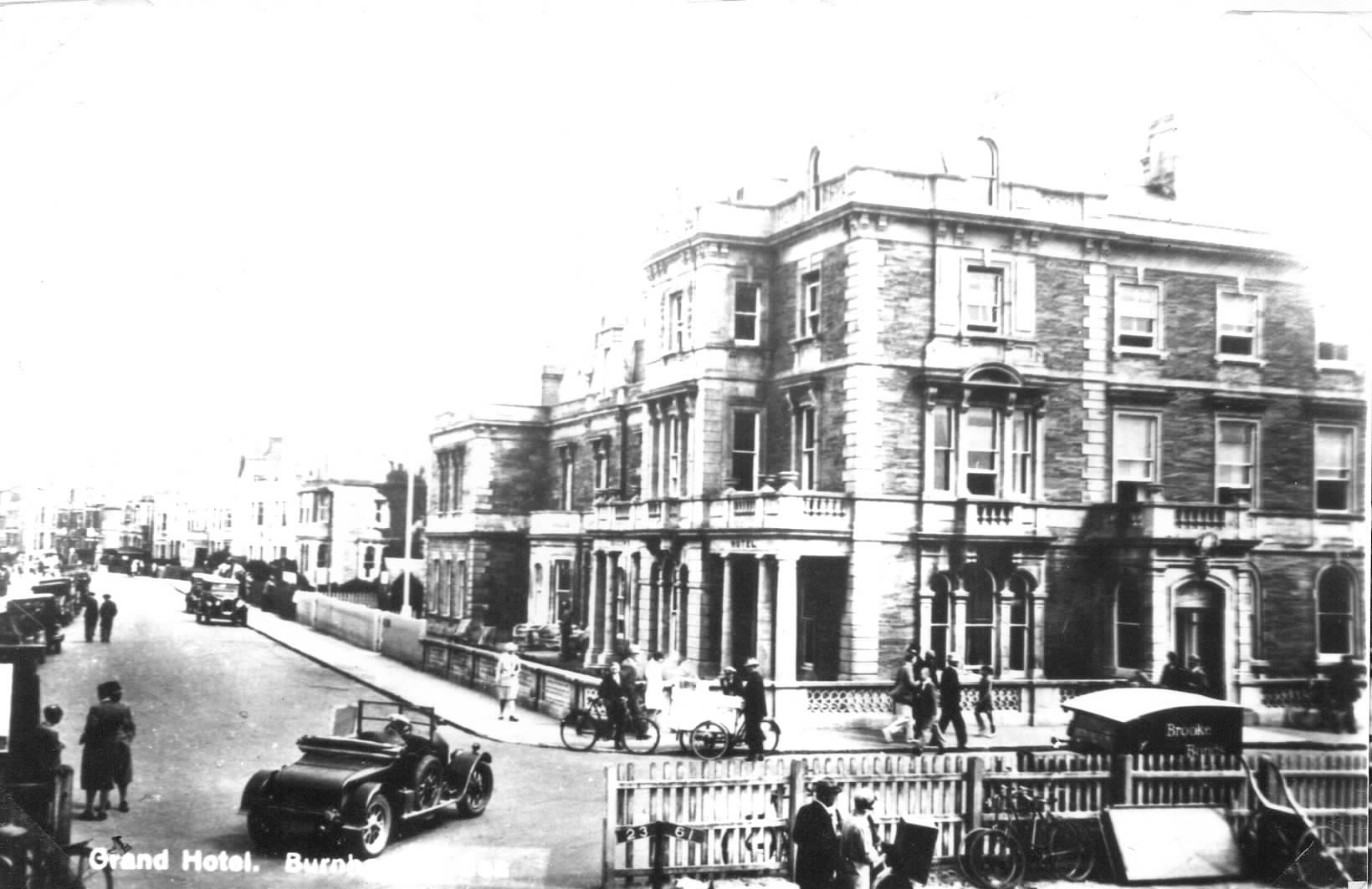
This brings us to Pier St and the boundary between the North and South Esplanades. The picture here is of the Reed’s Arms during the early 1920’s, Identified on its facade at the time of the picture as the ‘Queens Hotel’ but here labelled, probably mistakenly, as the ‘Grand Hotel’. The fence along the railway line link to the jetty is visible. This area would soon be opened up by the development of the South Esplanade and Marine Lake.
This is wonderful site with fascinating images and references to the history of Burnham-On-Sea. I’d love to have enlarged copies of some of the North Esplanade pictures. Is there anywhere I can buy these or get copies without reaching copyright?
Hello Martin and we are pleased you like our site. All the images have kindly been loaned by people on the basis that they will be used for educational purposes only. This policy was a condition of our Lottery grant. There are shops in Abingdon Street, the High Street and Victoria Street who sell historical images and artifacts.
Thank you for your interest,
John
Has anyone got more details of Burnham Boats? Our first craft was a Burnham 18, a beautiful little boat that slept four. Our family had so many happy holidays aboard her. Ours had a stern cockpit, but the versatile bunch at Burnham also designed her with a forward cockpit, as well as a central one. Would love to hear more.
Thanks for your question Dick. Hopefully other readers may be able to provide more details.
Hi, I own a small motor launch, a 12ft clinker built by Burnham motor boats. I have a couple of old magazine adverts for the company too. Let me know if you would like any pictures etc.
Regards Simon
Hello Simon,
We would be very pleased to post your pictures here. Many people I’ve spoken to remember the Burnham motor company. Unfortunately we don’t have any photos of the building that was in Maddocks Slade behind Catherine Terrace. So to have your photos would maybe prompt someone else to share their memories and photos.
Thank you,
John
I liked finding the QR web links on sea front, found them by chance. Very interesting and informative.
Thanks for your comment Mike. There should still be some leaflets about the whole Heritage Trail in the library foyer and also possibly in the information centre. There are a number of QR panels around the town. I guess you may have followed some of the links to other pages of the site and seen the whole map.