
Settlements are known to have existed in the Burnham area from the earliest recorded times of English history (see Iron Age map on River Siger page).
THE ROMANS
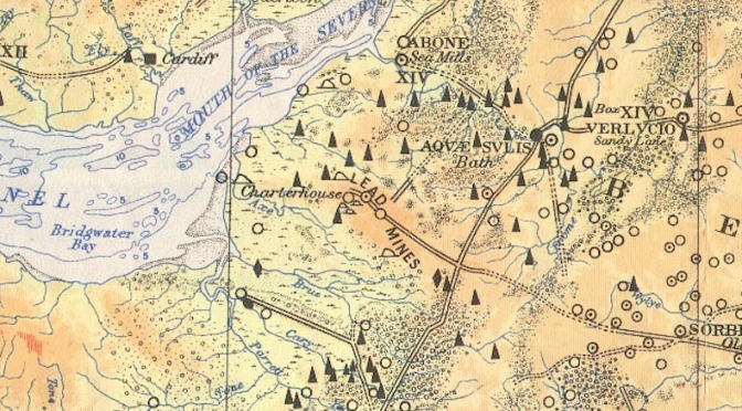
Roman remains (flooring, paving, pottery) have been discovered during excavations in the Worston Rd area. Samian ware, believed to be Romano-British was unearthed during an archaeological dig on the brewery site before the housing development in the 1970’s. The skeleton of a large dog or wolf was also found, its context on the site suggesting that it might have died having sought refuge there from high waters (from excavation notes by local historian Samuel Nash, held at Somerset Heritage Centre). It is known that there was a Romano-British temple on Brean Down, and also that the Romans had a substantial interest in the metals which were mined on the Mendips. There is evidence rom Nash’s excavations that the area south of the River Siger was used for salt production whilst the area north was drained for farming.
That Bridgwater Bay was known to early voyagers is evidenced by it’s inclusion on a map by ancient Roman geographer Claudius Ptolemy,where it is marked as the ‘Gulf of Uzzella’.
The legend of the visit of St Joseph of Arimathea is claimed by some to account for the historical usage of the name ‘Paradise’ for land stretching from the coast to Middle Burnham between Stoddens Rd and Brent Rd. The idea that this indicated Joseph’s route to Glastonbury is however thought unlikely as the terrain would have been very difficult to navigate at that time.
It is likely that traders in early times would have been landing near our stretch of the Bristol Channel coast in order to access the Mendip mining industry. However it is also likely that this would have been nearer to Brean down due to the difficult marshy terrain resulting from the disposition of the waterways conducting the water which is now channelled into the River Brue (see River Siger ).
Settlements in those times would have been around the meres and marshes on land above average water level. Inhabitants were known as Seomersetans (Seo-Mer-Seaton – dwellers by the sea and meres). The marshiness of the land around Brent Knoll led to it being known as Mons Ranarum (Mount or Island of Frogs) by the monks of Glastonbury. Mark Causway was the main dry track across to the higher ground at Blackford and Wedmore.
THE SAXONS
It was the nature of this terrain which made the headquarters of King Alfred at Athelney inaccessible to the invading Danes during the 9th century.
The Saxon ‘Herepath’

A major sea victory of Alfred’s forces over the Danes under Hubba took place in Bridgwater Bay, in which Hubba was killed. One of several different accounts of the origin of the inn name ‘Hobbs Boat’ (on the A370 near Lympsham) is that Hubba’s flaming death boat was pushed out to sea in the area but was washed back up the river to this site.
King Alfred was Lord of the Manor of Burnham and mentions it in his will so its existence as a named entity goes back to at least the 9th century and probably considerably further. The name is Saxon in origin: ‘Burne’, a stream or river and ‘Ham’ a settlement.
Land reclamation projects, driven principally by the regional Church organisation for purposes of agriculture and rents, gradually resulted in the establishment of more and more permanent settlements.
It is likely that the first settlers of Burnham were fishermen and the first houses would almost certainly have been near the Saxon church, which was later to become St Andrew’s.
In general the origin of the name Burnham (which occurs in many places around the country ) is from Old English burna “stream, spring” and ham “home”. More specifically, the Bristol Mercury guide book to Burnham, Somerset (1884) has the origin of our town name as being from the River Brue as in ‘Bruen Ham’.
MEDIEVAL TIMES TO 18th CENTURY
During the 10th century Burnham is recorded as being within the ‘hundred’ (a civic division) of Bempstone which extended inland to include Watchfield, Mark and Wedmore. The Domesday Book of 1086 records the existence of 18 households at Burnham, with 5 ploughs, 150 acres of meadow and 20 acres of pasture. In 1285 a royal charter was granted for an annual fair at Burnham.
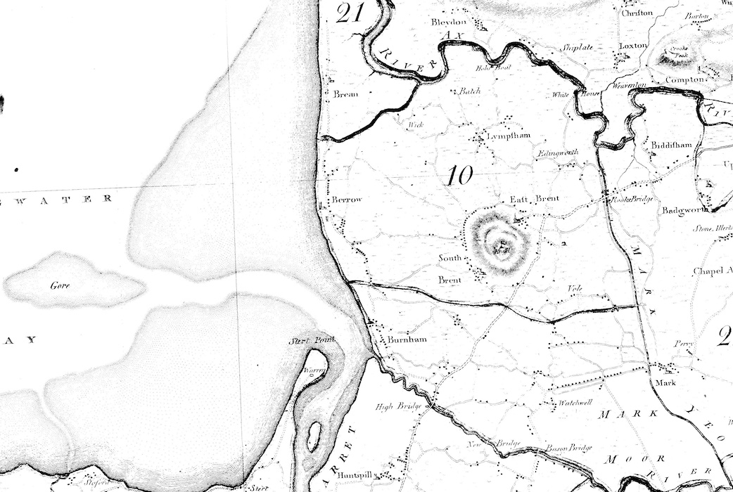
The map of 1577 below shows Burnham and Berrow just north of Brent Marsh

[see ‘Major Floods‘ for an account of the 1607 flood]
Apart from records of petty (mostly) crime, litigation and establishment of land title there is little local history of record, however, until the late 18th century. By this time there was a small established fishing and agricultural community at Burnham clustered around the church (now Victoria St, previously Church Rd) and among the coastal dunes and numerous farms with associated cottages inland. By the late 18th century the Royal Clarence Coaching inn was established.
One thing of which there is some record is the local impact of the English Civil War of the 17th Century. An example can be found in the book illustrated below.
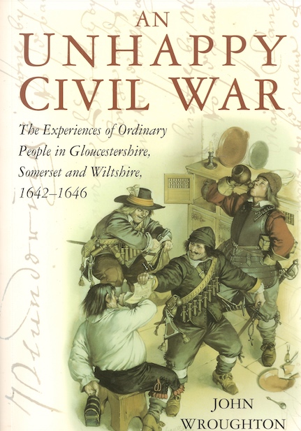
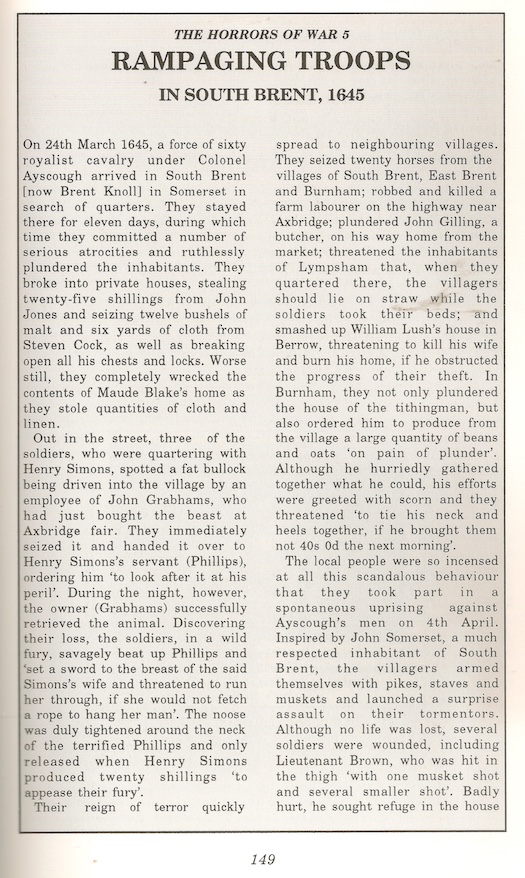
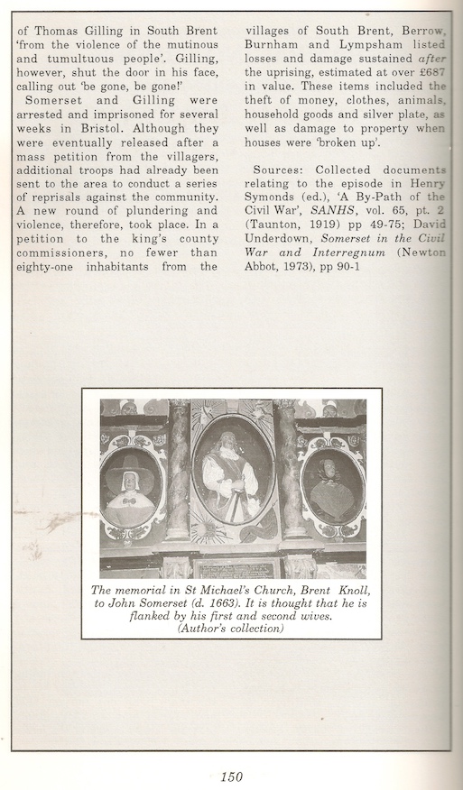
Extracts above by kind permission of John Wroughton.
Research by Alan Wheway has also uncovered records of the early Quaker movement in the area during the 17th century (additional information here.)
Until Victorian times the main routes to the outside world were sandy lanes: Paradise Road (Berrow Rd) to Stoaten Lane (approximated now by Stoddens Road) which went to Middle Burnham, where Love Lane met it, and proceded to Edymede (Edithmead) where it joined the Bristol Turnpike (A38) – see below; and Sandy Way (now Highbridge Rd) to Highbridge. These lanes were so poor that it was difficult for wheeled vehicles to use them.
Bath Chronicle 1778:

VICTORIAN TIMES
From around the time of Victoria’s accession the development of the Burnham we still see today commenced. In 1801 there were only 653 residents, by 1831 there were 1,113 (Parliamentary Gazeteer of England & Wales 1849).
The earliest commercial development in Burnham appears to have been mainly around the Church in what is now Victoria St and at the North end of this road, once known as Church St. We know little about this early phase but information in the notes of local historian Sam Nash gives us some clues.
Nash tells us that he identified 5 shops present in 1841: a post office; John Deacon’s butchers (Victoria St); Thomas King’s drapers (opposite churchyard gate) and another draper’s (this and the 5th not further specified). At around the same time he finds 3 “inns or public houses”: The Bell (not otherwise known under this name); The Crown and The Royal Clarence Hotel.
Nash’s notes also mention that in 1849 a fair was held on Trinity Monday for cattle horses and sheep. The notes do not elaborate as to whether this took place in other years.
Nas then lists a number of traders present in the town in 1852: William Baker, an ironmonger; William Daunton, painter and glazier; Richard Avent, grocer and linen draper; Jeremiah Baker, tailor; Robert Broad, butcher; WIlliam Clements, draper and grocer; George James, chemist; Ann King, draper and grocer ; William Legg, boot and shoe maker; John Lloyd, smith; Henry Mansfield, hairdresser; Maria Mansfiled, milliner; lewis Moor, draper and grocer; James Pearce, tailor; Peter Petherick, bookseller; Agnes Richards, “fancy repository”; John Richards, butcher; Robert Salisbury, builder; James Start, boot & shoemaker; Sealy[?] Stuckey, baker and confectioner; William Tucker, tailor; George Westlake, baker and William Woodman, boot & shoemaker.
We see some of these names recurring in connection with major retail businesses in the town in later years.
The report of the 1849 General Board of Health puts the total rateable houses in Burnham at 149 and records the 1841 population figures as 1,469 fr the parish and 769 for the town. In the same report John Buncombe states that when he arrived, 50 years previously, there had only been 25 houses in the town.
See also ‘Homebush and ‘Bug Row’.
————————————————————————————-
Ref: ‘The Book of Burnham on Sea’ by Winston & Robert Thomas, Halsgrove 2011.