
Contents:
- Edithmead
- Middle Burnham
- Berrow Rd
- Berrow (moved to Berrow)
- Brean (moved to Brean & Brean Down)
- Brean Sands Holiday Park (moved to Brean & Brean Down)
- Stoddens Rd
- Rectory Rd
- The Grove
- St Ann’s Villa
- The Colony
- Love Lane
- Harvest Home
- Deliveries
- West Huntspill
- P.C. Hillman (moved to Law & Order)
- Bob’s Ices
- Battleborough Grange
- Cheddar to Burnham Bus Service 1905 (moved to Bus Services page).
- Watchfield Windmill
- East Brent
- Brent Knoll
If you wanted to get out and about:
Unfortunately those on a tight budget might have to make do with being pulled by a goat.
However, if you arrived at Highbridge Station you might be lucky enough to find this conveyance awaiting to transport you to Burnham:
Here is a miscellany of local places and people
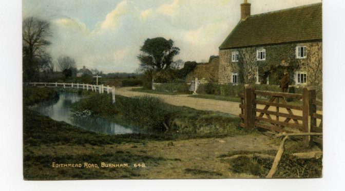
- EDITHMEAD
Photo at top of page, and below, dates unknown.
Edithmead is now known mainly as the site of a roundabout and motorway junction on the A38. As a village it has a long history, demonstrated by archaeological remains of an ancient earthwork and possibly an early fort.
A retrospective article by Ivor Punnett in the in the Weekly news in 1991 gives us many memories of local residents.
Phyllis Wyatt, author of “A Somerset Childhood’ recalled:
“Father was a poacer. His work jacket had large poacher’s pockets in the lining and many were the dinners he brought home after a seemingly innocent stroll around the fields. Thanks to father’s skill we never went hungry.” For clearing a stretch of rhyne “his price of four pence per rope, a linear measure of 20 feet, was the same each year and was always accepted.”
Tom Bennett’s family came to Chestnut farm in Edithmead in the early 19th century. He was responsible for the expansion of the award winning family cider business which continues to this day. The business supplied the Crown Inn and expanded to supply 13 other local pubs. He recalled, of the Henbury family:
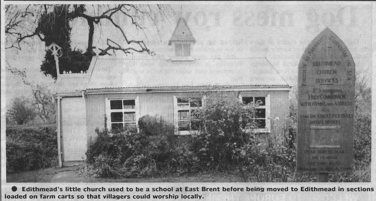
“they were very good to the village and donated the land on which the little church [The ‘Tin Church’] now stands. It was originally the school at east brent and was brought here in sections on farm carts.”
Mrs Maud Drew (then 90) recalled:
“I used to play the organ for services which were held in an old railway carriage and I remember the excitement when the carts brought the sections of the church to the village….Dad was a well known cattle dealer and he sometimes used to go to Cardiff on business. He always took the steamer from the old Burnham pier.“
Mrs Marjorie Tibbs, who’s sister Grace was one of the first two babies christened in the church, remembered:
“There used to be a tiny shop in the village, kept by Matilda Blew, known to everyone as Tilly. At first it was a small hut beside her home and, of course, it was the centre where all the local news was exchanged. We children used to get a halfpenny for cutting the lawn and we would hurry off to spend it at her shop. You could get quite a few sweets then for a farthing. She also played the piano at Highbridge cinema for the silent films which we children used to love to go and see.”
She also recalled that during WWII “A German bomber fleeing from a fighter had scattered a load of incendiaries and one or two had fallen on the house and it was burned out. Luckily no one was injured….I do remember how kind everyone was in the village. they did all they could to help.”
2. MIDDLE BURNHAM
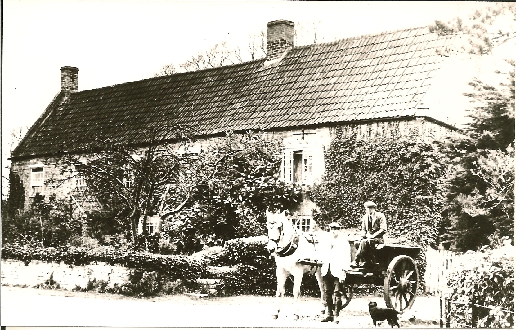
Middle Burnham Farm with K. Knight (L) & C. Butt (R).
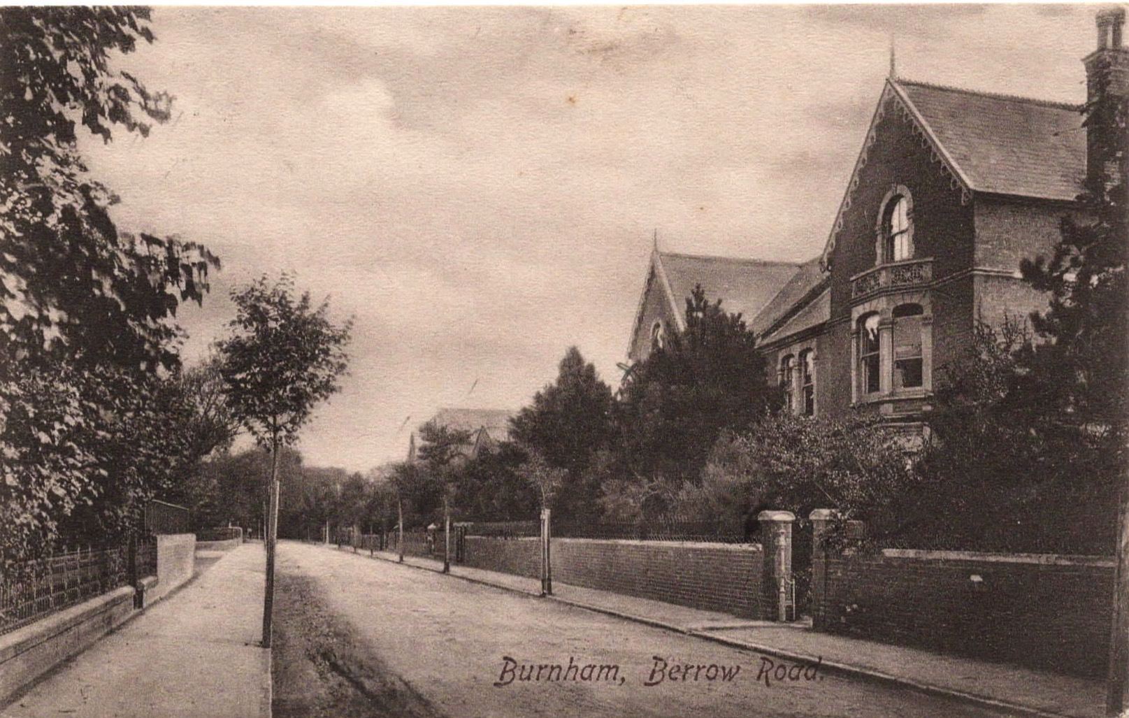
3. BERROW RD
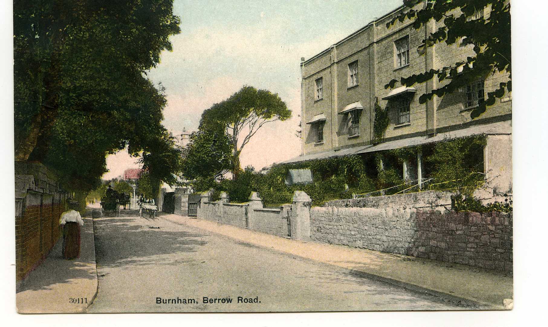 Above: Brunswick Terrace.
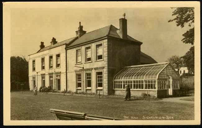
‘The Hall’, now the Community Centre
Oakover Girls School (below), at the bottom of Sea View Rd.
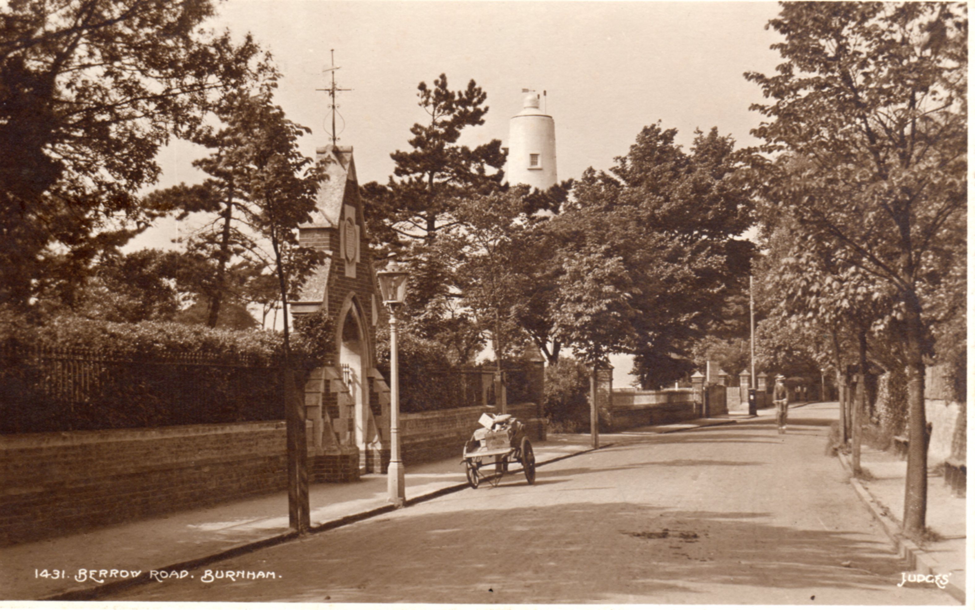
Above, entrance to Ellen’s Cottages & High Lighthouse, note benches opposite.
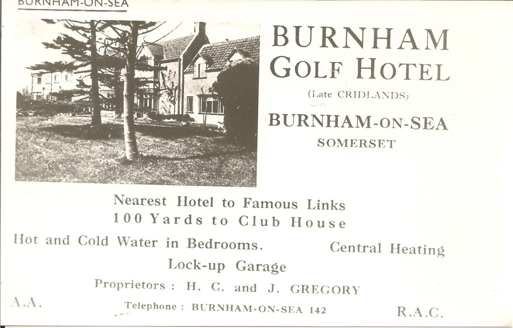
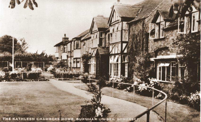
Below: The Golf Hotel, later to become Kathleen Chambers House an RNIB establishment. This was opened for its new purpose in 1953 by Mrs kathleen Chambers, ex Lord Mayor of Bradford and campaigner for women and for the deaf-blind. Now rebuilt.
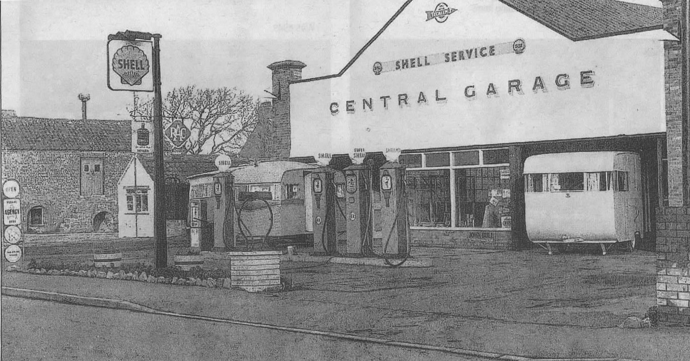
Below is a photo of the Central Garage in the 1950s, publlished in the Burnham News in 2010 courtesy of Iris Rowe. The building on the left was used by Bowley & Skuse and the wartime air-raid siren above it was actually on the pumping station beyond.
4. BERROW
SEE ALSO ‘PARADISE’
5. BREAN
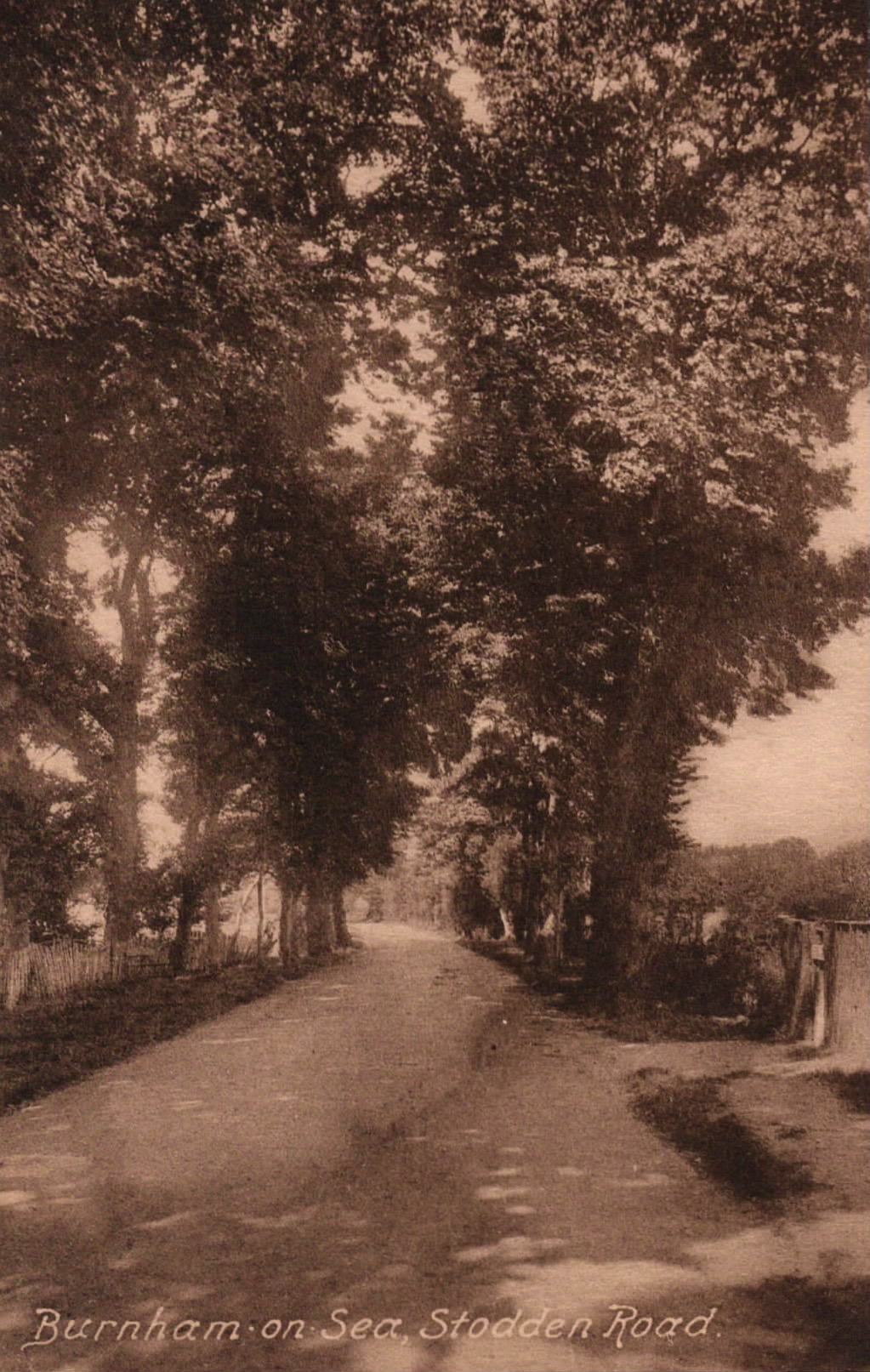
7. STODDEN’S RD
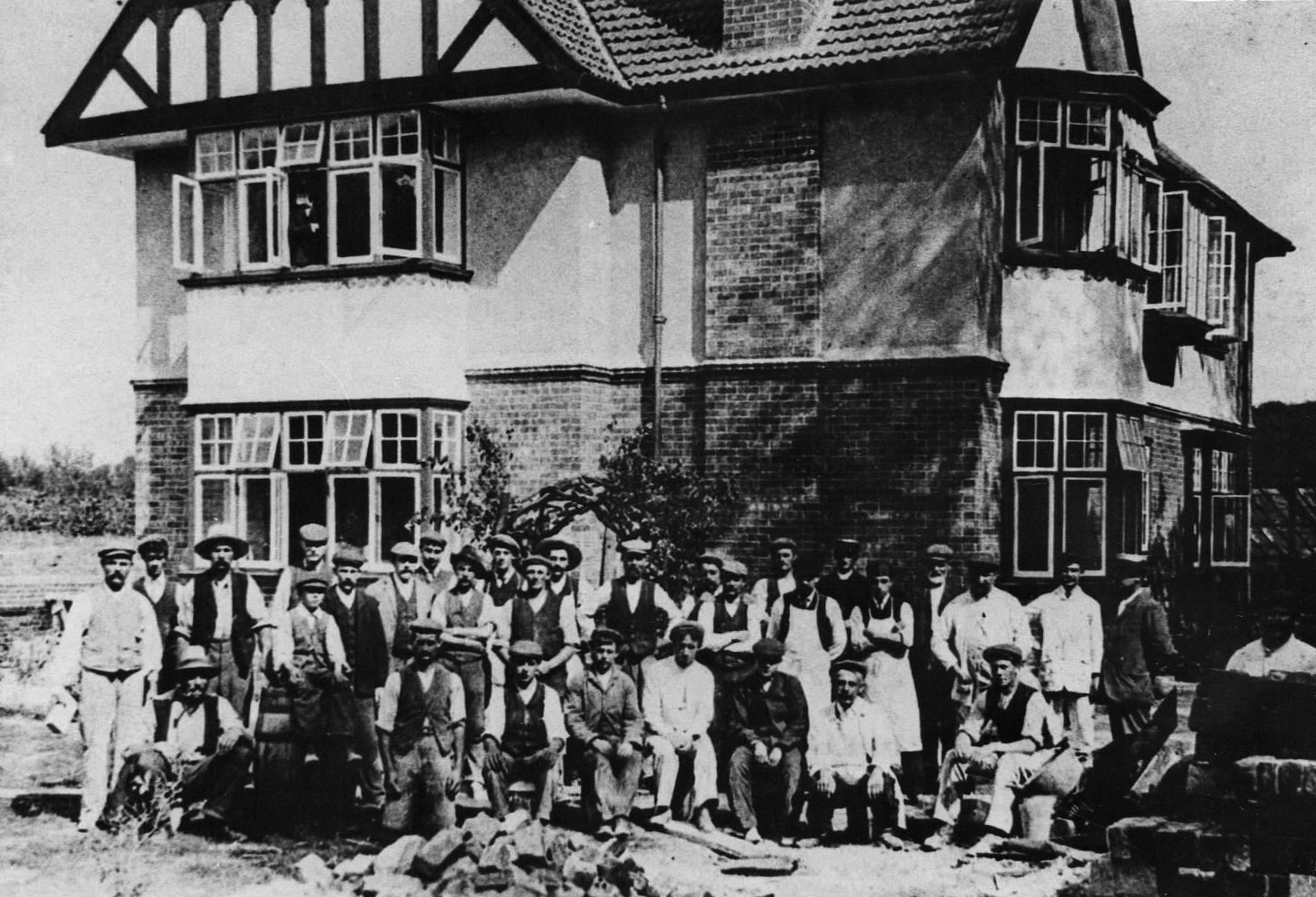
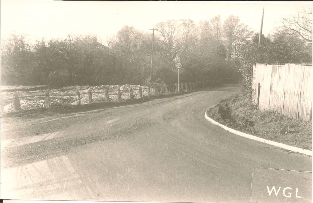
8. RECTORY RD
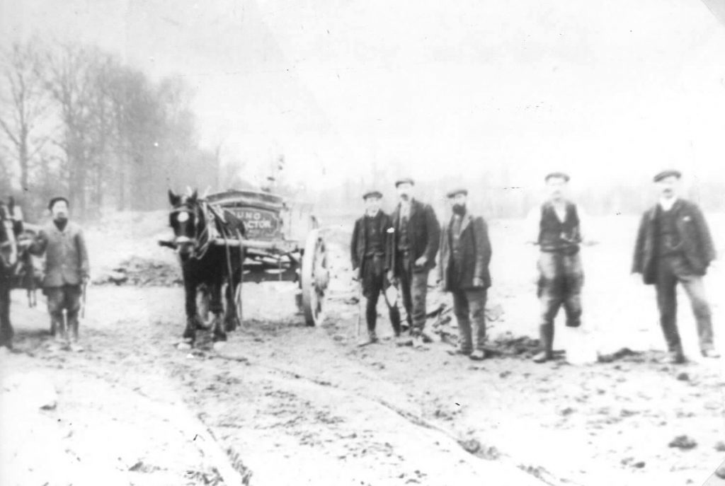 Henry Young and his men building Rectory Rd 1904.
9. THE GROVE
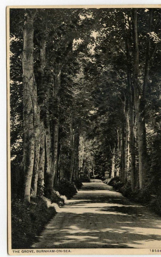
The large house known as ‘The Grove’ stood in extensive wooded grounds where the road Gardenhurst now runs, north of Rectory Rd. It is thought that the house may correspond to what was known as Paradise House in the 1834 sale notice below. (see also ‘Paradise’)

The ‘Mr Don’ mentioned is probably Henry Dod who with his wife Susan who is recorded in the 1841 census among the residents of ‘Paradise’.
‘The Grove’ later became known as Hart House and during the early part of the 20th century was enlarged to become the Manor Hotel. The Rectory, to the south, later became known as Gardenhurst and served as a school. It eventually expanded to take in the Manor Hotel. The building still stands, much expanded, as the care home ‘Beaufort House’.
Map below is from o.s. 1844-88.
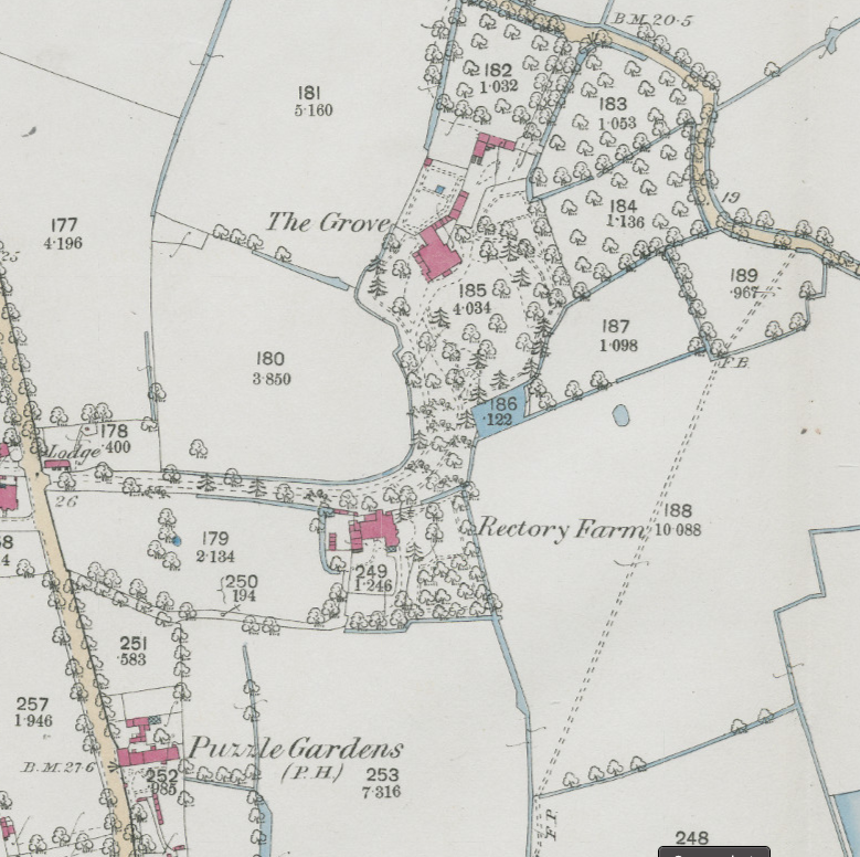
The area was developed for housing during the early years of the 20th century.
See also Paradise House.
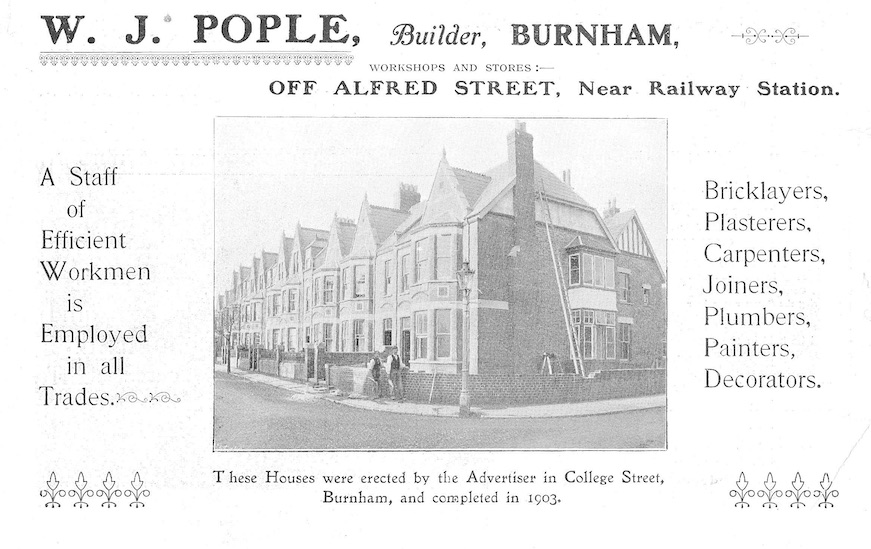
POPLE’S BUILDERS
10. ST ANN’S VILLA
One time home of Lord Cave and of John Saunders, the Villa dates to at least 1841 when it was owned and occupied by Edward Harwood. By 1863 it was known as St Ann’s, at which time it was owned and occupied by Robert Boyd.
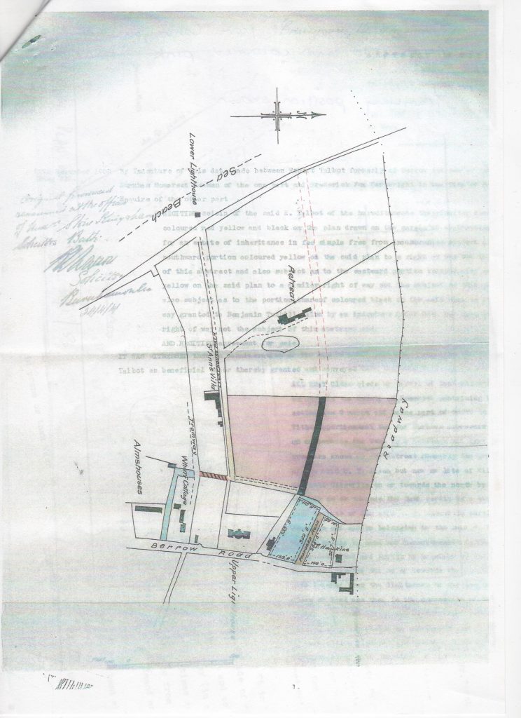
The map shows the course of St Ann’s lane, leading between the high and low lighthouses, it is interesting to speculate whether this is a remnant of the course of the ancient River Siger. There is anecdotal evidence that trows would at one time land coal directly onto the beach near the low lighthouse and that it was transported to the road by a narrow gauge horse railway along what was then known as Trinity Lane (between the lighthouses) . The line of this is probably what is marked as ‘Tramway’ on the map above.
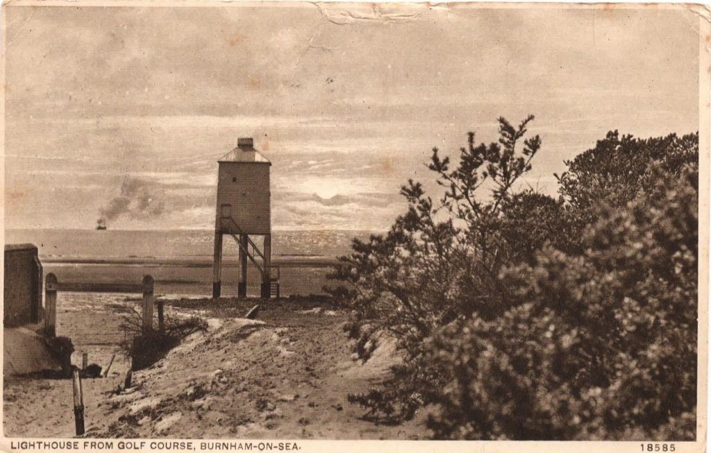 Low lighthouse from St Ann’s Lane
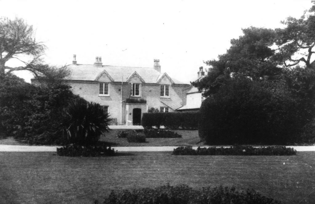 The Villa
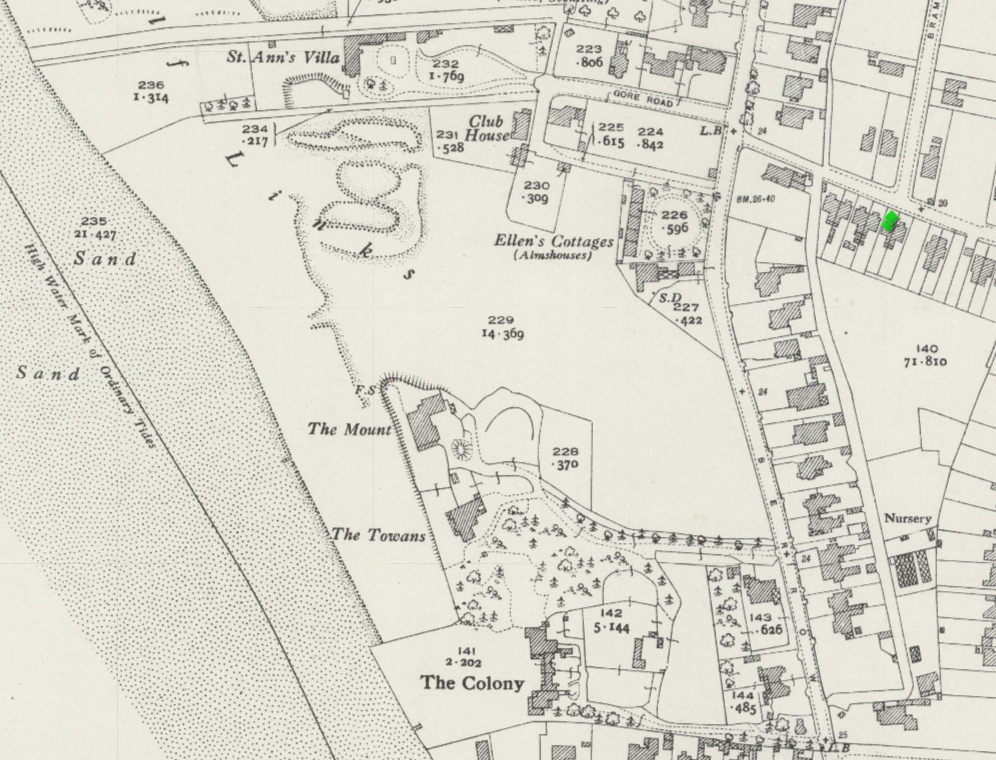
Map (o.s. 1921- 43) showing the relative positions of St Ann’s Villa, Ellen’s Cottages, The Mount, The Towans and The Colony.

11. THE COLONY
This appears from the engraving to have been a sizeable handsome building. However, Sam Nash’s records tell us that it was originally built by Henry Dod in 1836 as “Two tasteful houses…in the cottage style”. By 1841 it was known as Dod’s Cottages and by the 1860’s as ‘The Colony’. It appears by that time that it may have constituted a small number of separate residences. It is shown, in census information and trade directories from 1848 to 1939, to have been occupied by a series of families mostly of business owners, clergy, ‘gentry’ or other people of independent means. Occupants included John Prior Estlin (1866) brick manufacturer, merchant and member of the Local Board Committee (later of ‘Tregunter‘ and Marine House on the Esplanade).
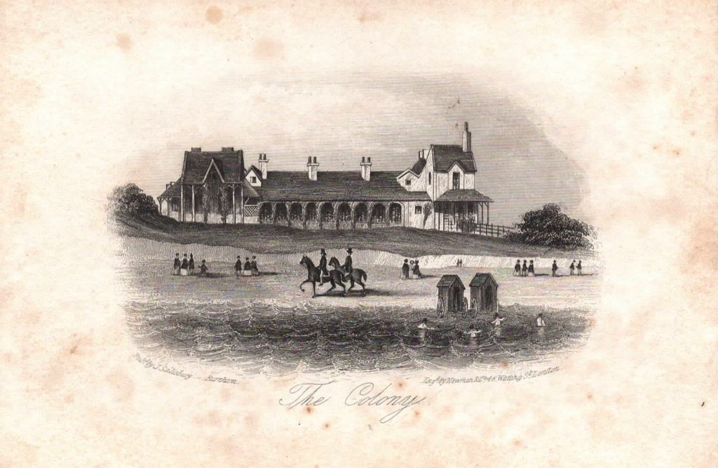
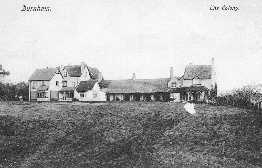
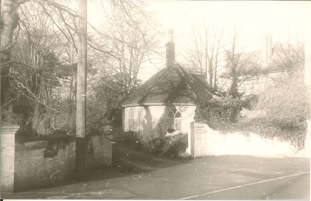
The Colony Lodge, still standing on the Berrow Rd
12. LOVE LANE
Frost’s farm house and outbuildings stood on the site now occupied by the Medical Centre and the Ambulance Station.


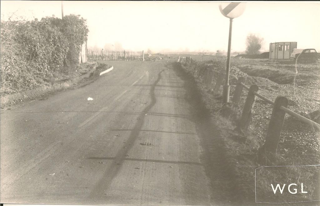
Below, the beginning of works for new road to the A38 (Queens Drive).
13. HARVEST HOME
Burnham Star 1901:
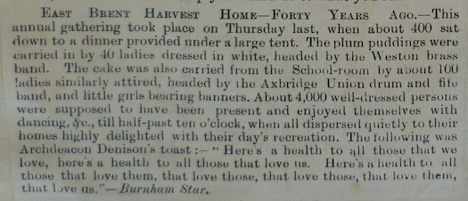
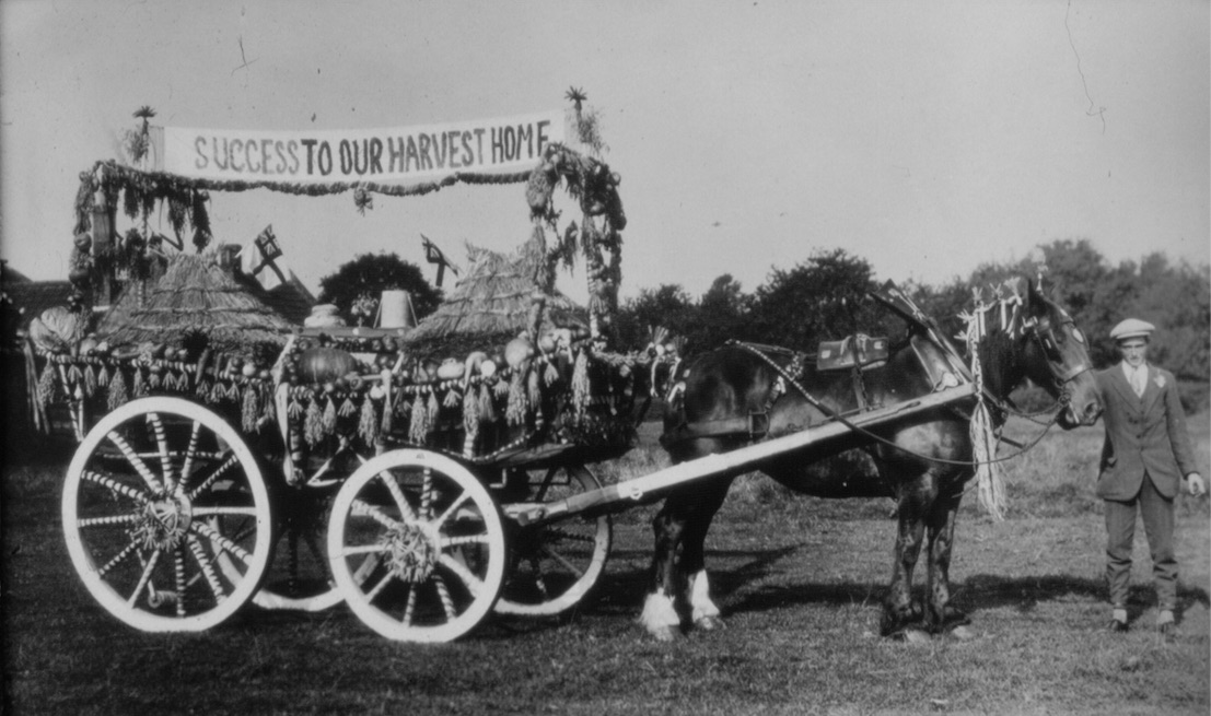
Farm carts were decorated for the celebrations.
See also press report from 1859 at bottom of George Reed page.
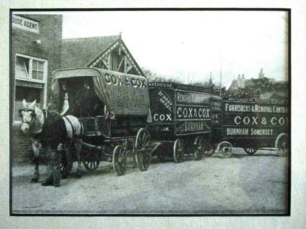
14. DELIVERIES
COX & COX
Cox & Cox had premises at the north end of Victoria St but their warehouse was near to the brewery on Highbridge Rd. Their wagons would no doubt have been a familiar site on the local roads.
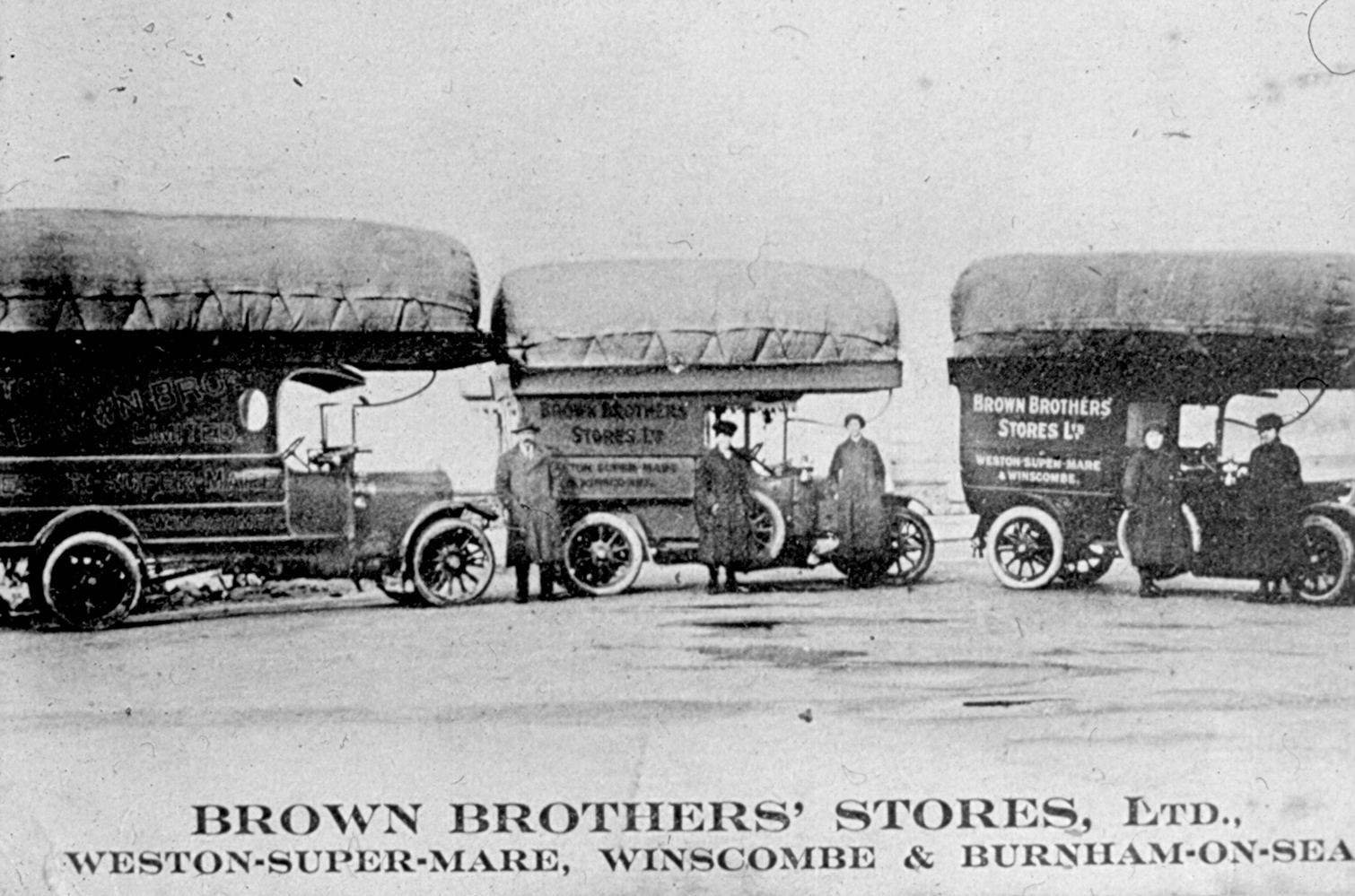
BROWN BROTHERS
The Weston grocery company had a shop at No. 51 High St, Burnham during the first half of the 20th century. At one time, probably during World War I fuel shortages, they operated a fleet of gas powered delivery vehicles (see comment from Des Parsons below).
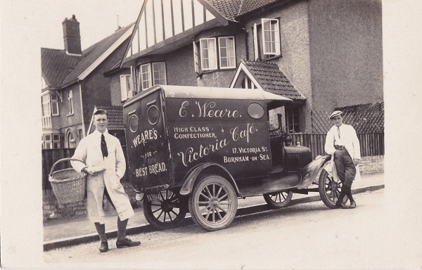
WEARE’S BAKERY
Weare’s shop was in Victoria St. Their delivery van is here seen making a delivery to ‘Osra’, the house on the corner ofGolf Links Road. The date is not known but the vehicle appears to be of 1920’s vintage.
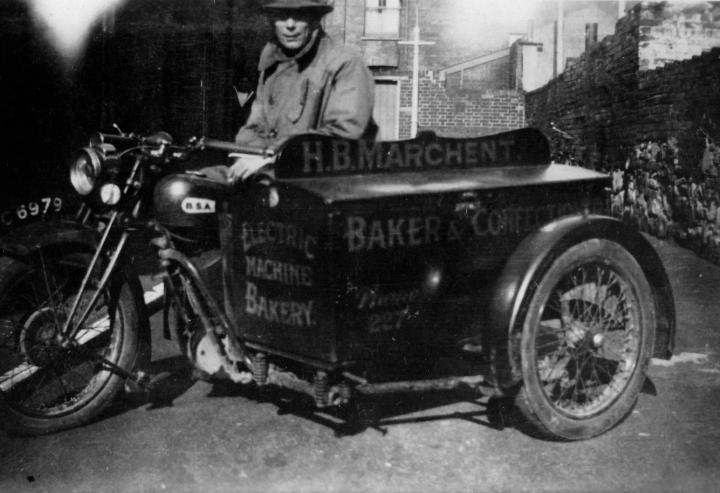
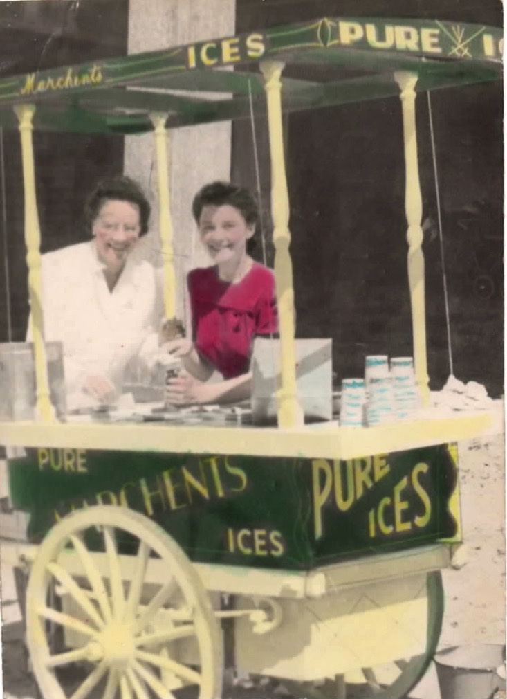
MARCHENT’S BAKERY
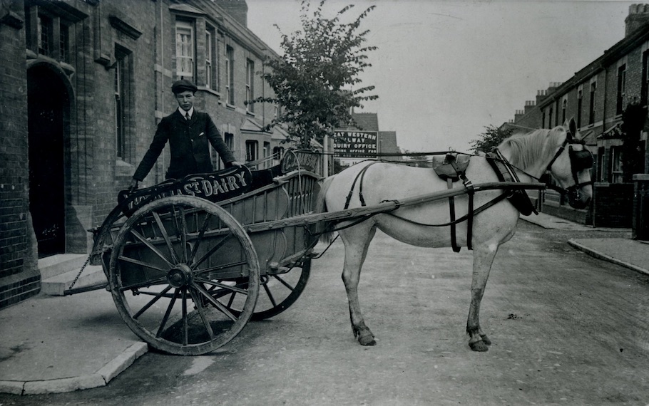
DAWSON’S VICTORIA DAIRY
Dawson’s Dairy & Grocery occupied No 41 Victoria St in the early years of the 20th century
LAWRENCE’S BUTCHERS 31 College St.

We have been informed by members of the Lawrence family that the picture above is of William Bertram Lawrence, who was probably about 12 at the time, which would date it around 1911.
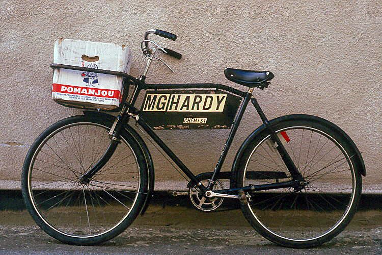
Even as late as 1986 some deliveries were being made by bicycle in Burnham
15. WEST HUNTSPILL
The Globe Hotel (now the Pimpernel, previously the Huntspill Arms and before that the Scarlet Pimpernel). The date is unknown but is sometime after 1916, when the Derham family took over the hotel for Holts Brewery (until 1949). The sign at right has a pendant marked R.A.O.B. which probably indicates a meeting place for the Royal Antediluvian Order of Buffaloes, a fraternal organisation started in 1822.
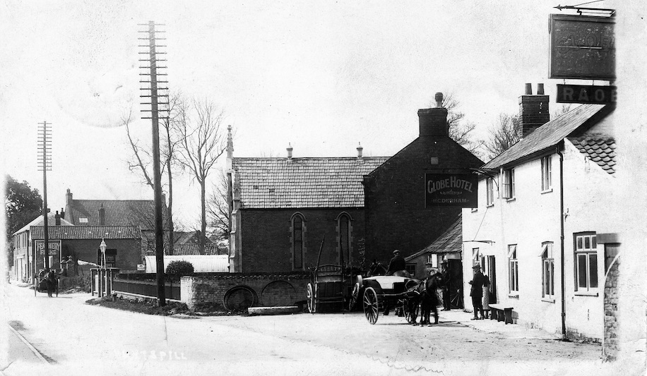
Below: charabanc excursion at the Crossways Inn.
16. P.C. HILLMAN (moved to Law & Order)
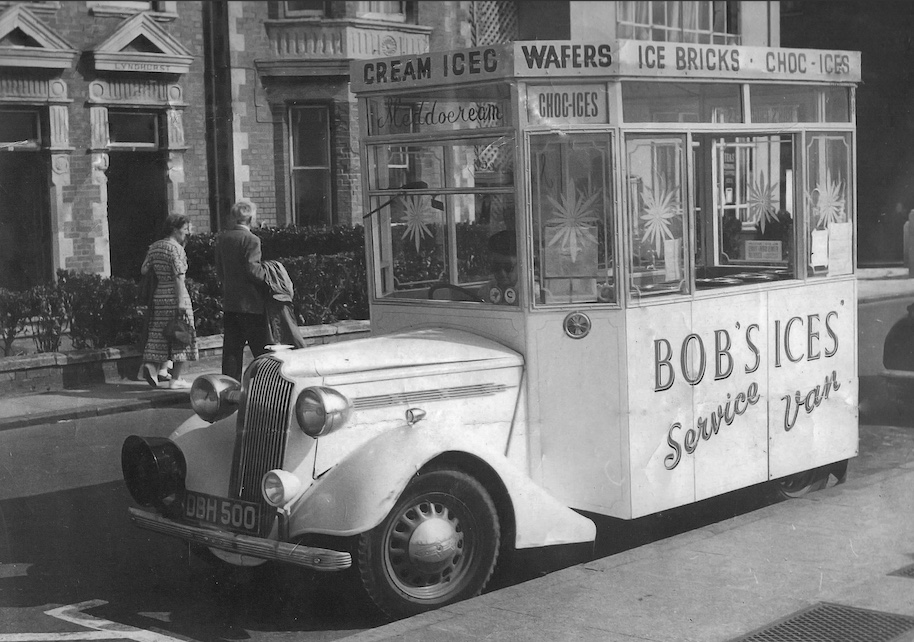
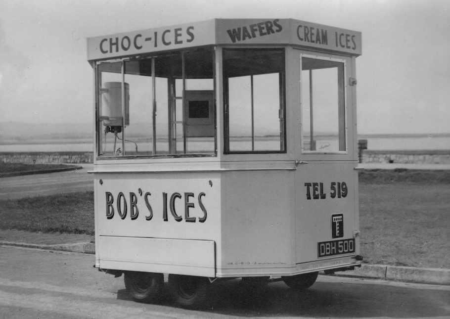
17. BOB’S ICES
This mobile business was run by a member of the Marchent family who ran bakery and tea-room businesses in Burnham for many years. It was the first to start up in Burnham after World War II.
18. BATTLEBOROUGH GRANGE
Francis Farr-Cox recalls:
“One of my favourite childhood memories is of going to Battleborough Grange for a cream tea. I have a suspicion that we probably only went there two or three times possibly when relatives came to visit us at Burnham. In those days Battleborough was a working farm and as you went up the drive I seem to recall both the sound and smell of what I now suspect was a working Lister or similar stationary engine plus a glimpse of the cows that were responsible for the cream we were about to enjoy.
Teas were served in a large dining room which felt like part of the home rather than a room specially for visitors. My recollection is that the delicious cream made on the farm and the jam were served with bread and butter. Battleborough was known as the place to have a cream tea. I think I was told when I was a bit older that Battleborough was known far and wide for its cream teas partly because the owners had been prosecuted for serving cream teas during rationing when this was not permitted. Searching the British Newspaper Archive bears this out. A case heard in 1949 when the married couple who owned the farm were each fined £25 plus three guineas costs was reported not just in local papers but also in Exeter, Birmingham and even Dundee! There were probably many other reports that are not in the Archive! One of the papers reported that the Ministry of Food enforcement officer said that when she called at the Grange there were about 40 people having tea and they all had cream. A saucer of cream was placed on her table but she did not have any. She took samples of the cream and had it analysed. It was cow’s cream.
Scones in a cream tea appear to be a modern idea possibly because they can be made quickly to suit demand. The Foods of England website has a section on cream teas. The earliest reference to a cream tea the authors of the website could find was from 1931 when a disgruntled correspondent wrote about the price he had had to pay for a cream tea, served with a “splashing of cream”, bread and butter and two “anemic” rolls in Cornwall. The same website also includes a case paralleling the one at Battleborough when a farmer at Bickleigh in Devon was fined in 1942 following a visit by a Food Enforcement Officer. He had been served “tea, milk ,sugar, bread and butter, plain bread, jam and a glass with three or four ounces of cream.
In my opinion scones are fine but a cream tea with brown bread and butter is delicious and clearly much more traditional!”
19. CHEDDAR TO BURNHAM BUS SERVICE 1905 (Moved to Bus Services page)
20. WATCHFIELD WINDMILL
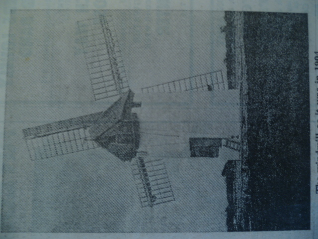
Photo above taken in 1904. A local press report from 1979 tells us that the mill was worked more or less throughout the 19th century, largely by the Spearing family, and ceased activities just before WWI. It was 26ft high, 12ft in diameter at the ground and at one time had a thatched roof. A beam engine was installed in the 1890’s.
21. EAST BRENT
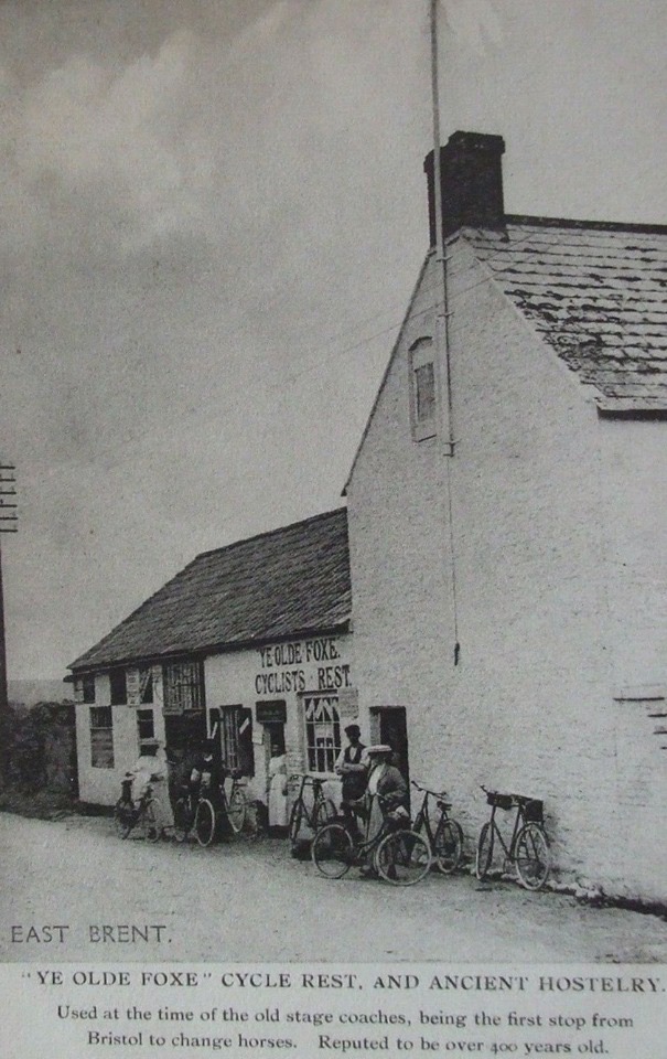
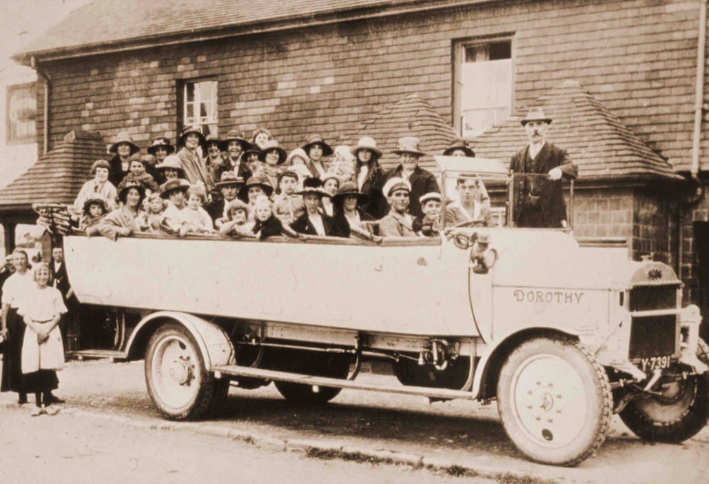
The photo above appears to have been taken in the early 20th century during the height of the cycle touring fashion. Any information about this pub would be appreciated (Please comment on at bottom of page).
22. BRENT KNOLL
Mary Price’s research of the history of Brent Knoll, reported on by Ivor Punnett in the Burnham & Highbridge Weekly News in 1990, tells us that until the late 19th century Brent Knoll was known as South Brent. The coming of the railway in 1884 necessitated the renaming as there was already a South Brent Station in Devon. In 1880 there was a steeple chase around the Knoll which included 106 water jumps. In the 1930s the village had six shops including a tailor & bootmaker, and three blacksmiths. Many of the farmers made Caerphilly cheese which was sold at Highbridge cheese market.
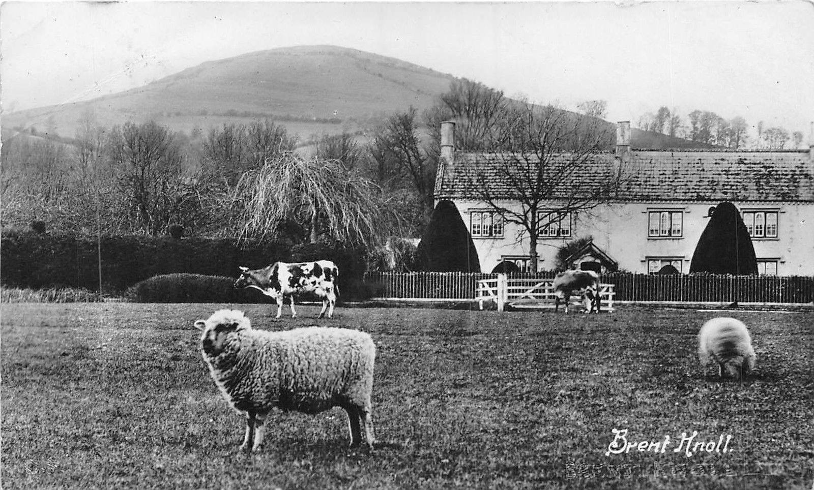
The same report tells us that there is a memorial in the church to John Somerset. He was imprisoned at Bristol during the English Civil War for attempting to help villagers in their complaints against Royalist troops, quartered in the village, who had stolen 26 horses from them.
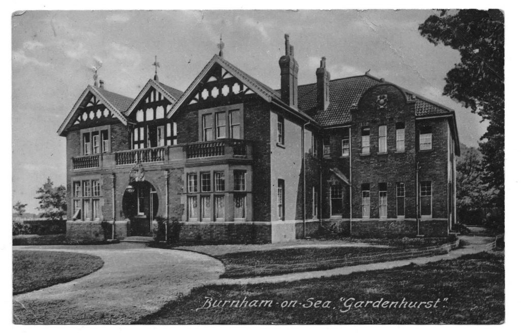
More of an afterthought! I spent three years at Gardenhurst then a private school from 1939-42. My parents thought it would be safer than the school I had been in in Kent, though evacuated. The Junior school was run by a very large woman Miss Rose and the Senior by a more slight lady Miss Winnifred. The houses were on Rectory Road. I think everything was done that we had a fairly wide education but there was no sixth form. We were very saddened when our German teacher was taken to be interned at the Isle of Man. She was a nice, innocent woman and it must have been very hard. We had Mlle le Gough to teach us French and Miss Clerk who was a wizz at golf to teach us Math. There was a riding school not far away and we had a marvelous time riding on the sands. When the tide came in, very infrequent, all work at the school would stop and we would don our bathing costumes for a very pleasant swim if we could avoid the mud.
We played hockey on the sands and it was a great game, quite fast.
Thanks for your recollections Jenny.
18. Battle Borough Grange This was my nans house and she was the first one to do cream teas. Yes it was a working farm my father and his sister were both born in the house. Wish I could contact the person that wrote about visiting my nans home
Hello Michelle,
I will contact the person you mention and see if they wish to communicate with you.
Thanks for your posting and fingers crossed you will get to ‘talk’.
John
Many thanks. I hope they do would be interesting!
I spent my childhood in this area and my first recollections of my life were living at The Colony on Berrow road where I believe my mother was a housekeeper for the Skrimshire family and my father was the gardener. We moved into a new council house in Edithmead in about 1949/50 when it was built after the war ended. Some of the names mentioned in several articles on this site were well known to me in my young life and brought back some special memories. One thing that surprised me was that Rectory Road, where my aunt still lives, was built by a builder called Henry Young and that was my mother’s maiden name, which leaves me to do some heritage searching.
Hello Michael and thanks for sharing your early times in Burnham.
We would love to hear more about these if you have time.
Thanks again,
John
Thanks for you reply John and I could ramble on about my Somerset past until the cows come home. The Hemburys in Edithmead has noisy peacocks on their farm and you could hear them throughout the village and they were always very kind to me when I went to see their farm. The first photo on this page brings back bad memories of cycling past the property on my way to BOS in the middle of winter after being sent to get a sack of coal to warm the house whilst my hands were freezing to death. Much against my mother’s wishes I bought a delapidated canoe from one of the Rice family and had it hidden on the pond next to the railway bridge, but it met an untimely demise when my dad found out. Sadly I can remember the tragic deaths of 2 Highbridge lads that I knew who were killed when a tunnel they had built in the sand dunes collapsed on them, probably in the mid-50’s which sent the local community into shock. My Mecca has always been Brent Knoll and in fact I have requested my ashes to be scattered at the top next to the memorial stones which I believe my past family were instrumental in the placement up there back in the day. Other names I can remember from my Edithmead days would be Arundell, Pleece, Watts, Pollard (local postwoman) and many others. I was a member of Brent Knoll Cubs and used to walk across the fields from my home in all kinds of weather and that included our locally famous “cowslip field”. If there should be anyone on this site who would like to correspond I would welcome the opportunity because my memory at age 80 is still as sharp as a tack and I can still recall all of the lovely people I used to meet on my rounds of delivering meat to house around Berrow for 2 butchers (Weed and Bush) plus the Maiseys Bakery route and my Sunday paper round based at Orchards fruit on the A38 at Edithmead.
Thanks Michael,
I hope someone reads your message and want’s to get in touch,
John
Hi. Do you know anything of the Popham/ williams family in the Brent knoll area. Also the Ducketts?
Hi all. The section on Edithmead has a name incorrectly given. The name should read Hembury and not Henbury. They were the farming family living at Edymead (later Edithmead) Farm. Jesse Hembury was the old man who owned the farm. He died in 1915 and his three sons, William, Arthur and Frederick carried on running the farm. These would have been the ones who gave the small parcel of land for the church to be placed. I was born and lived in the bungalow opposite their farm entrance. It had a milk stand to the left as you turned into the drive. I clearly remember Fred in the late 1950’s offering me apples to do odd jobs for them. He was born in 1897 and would have been well in his 60’s when I got to know him. He died in 1963 age 66. They had a Medlar tree in the garden outside the kitchen.
The Brown Brothers Gas vans were converted to run on uncompressed “Town” or “Street” gas. This gas was available as a by product from turning coal into coke. Our local Burnham Gas Company (and Weston) probably supplied the gas for these vehicles, making the conversion worthwhile. Fuel was often in short supply during the war periods for obvious reasons. Vans and buses were more suited for the conversion because of the size of their roof. Cars were often converted but looked hideous with the large balloon on the roof, but what did it matter, there was a war on. These look like WW1 vehicles but many more were also converted and used during WW2. The Dutch, French and German’s also had their versions of gas vehicles. I am led to believe that 1 litre of fuel had to be replaced with 2-3 cubic metres of gas? Petrol engines would run easily on gas but Diesel engines still need diesel to start, then switch over to gas.
Thanks for the information Des. I have signposted in the text by the picture.